

10.2.3.2 Canada Crop Inventory
Crop inventory (CI) of Canada is an operational, annual crop mapping using satellite
Earth observations. Both optical remote sensing and radar-based satellite images are
used in the classification. Optical sensors include Landsat 5, DMC, SPOT, Landsat
8, Sentinel-2, and Gaofen-1. Radar sensor is RADARSAT-2. Ground truth information is provided by provincial crop insurance companies and field survey by the
Agriculture and Agri-Food Canada (AAFC). A decision tree classifier is used in
classifying the images.
CI produces crop maps of Canada annually since 2011. The operational release of
annual crop inventory allows the monitoring of cropland changes over the years. The
crops include barley, millet, oats, rye, triticale, wheat, corn, borage, camelina, canola
and rapeseed, flaxseed, mustard, safflower, sunflower, soybeans, peas, beans, lentils,
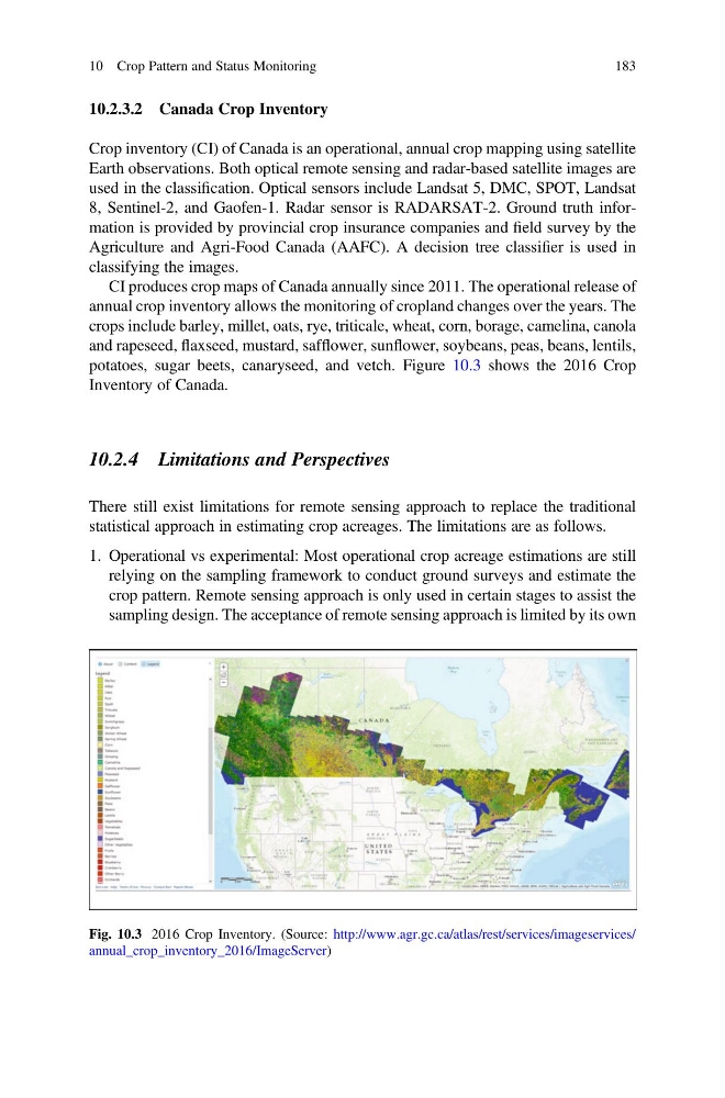
potatoes, sugar beets, canaryseed, and vetch. Figure 10.3 shows the 2016 Crop
Inventory of Canada.
10.2.4 Limitations and Perspectives
There still exist limitations for remote sensing approach to replace the traditional
statistical approach in estimating crop acreages. The limitations are as follows.
1. Operational vs experimental: Most operational crop acreage estimations are still
relying on the sampling framework to conduct ground surveys and estimate the
crop pattern. Remote sensing approach is only used in certain stages to assist the
sampling design. The acceptance of remote sensing approach is limited by its own
Fig. 10.3 2016 Crop Inventory. (Source: http://www.agr.gc.ca/atlas/rest/services/imageservices/
annual_crop_inventory_2016/ImageServer)
10 Crop Pattern and Status Monitoring
183
Crop inventory (CI) of Canada is an operational, annual crop mapping using satellite
Earth observations. Both optical remote sensing and radar-based satellite images are
used in the classification. Optical sensors include Landsat 5, DMC, SPOT, Landsat
8, Sentinel-2, and Gaofen-1. Radar sensor is RADARSAT-2. Ground truth information is provided by provincial crop insurance companies and field survey by the
Agriculture and Agri-Food Canada (AAFC). A decision tree classifier is used in
classifying the images.
CI produces crop maps of Canada annually since 2011. The operational release of
annual crop inventory allows the monitoring of cropland changes over the years. The
crops include barley, millet, oats, rye, triticale, wheat, corn, borage, camelina, canola
and rapeseed, flaxseed, mustard, safflower, sunflower, soybeans, peas, beans, lentils,
potatoes, sugar beets, canaryseed, and vetch. Figure 10.3 shows the 2016 Crop
Inventory of Canada.
10.2.4 Limitations and Perspectives
There still exist limitations for remote sensing approach to replace the traditional
statistical approach in estimating crop acreages. The limitations are as follows.
1. Operational vs experimental: Most operational crop acreage estimations are still
relying on the sampling framework to conduct ground surveys and estimate the
crop pattern. Remote sensing approach is only used in certain stages to assist the
sampling design. The acceptance of remote sensing approach is limited by its own
Fig. 10.3 2016 Crop Inventory. (Source: http://www.agr.gc.ca/atlas/rest/services/imageservices/
annual_crop_inventory_2016/ImageServer)
10 Crop Pattern and Status Monitoring
183