

The inconsistencies in land parcel collection and storing format lead to the loss of
dataset integration. Different data collection methods may lead to results with
different accuracy levels. It is true that the data inconsistency could be simply solved
by enforcing all data collectors to use the same data collection method. However, not
all countries have the same techniques to collect and manage land parcel data.
Significant technology gap could be found between developed and developing
countries. Adopting new techniques such as remote sensing and GIS brings an
alternative for measuring land parcel for agro-geoinformation systems. In addition,
land parcel identification is based on geomorphology while considering the administrative boundaries as well. This nature of land parcel identification, which is the
finest unit in agro-geoinformation system, makes the research outcome comparable.
The sharing of land parcel information is extremely significant in the global agrogeoinformation systems; however, it also has some problems. One of the largest
problems is reflected in the motivation of sharing such data. As the chapter discussed
earlier that counties lack the motivation to contribute the national land parcel
database, international land parcel management faces the same issue. Individual
nations may not share their data due to either lack of motivation or worry about the
national securities. Although there are several approaches to effectively identify and
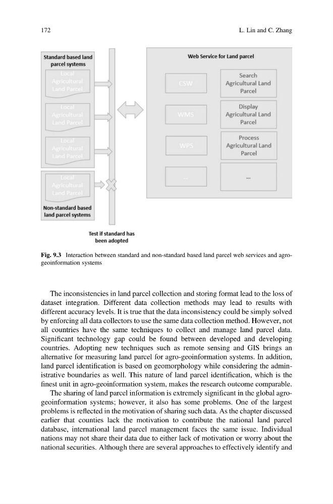
Fig. 9.3 Interaction between standard and non-standard based land parcel web services and agrogeoinformation systems
172
L. Lin and C. Zhang
dataset integration. Different data collection methods may lead to results with
different accuracy levels. It is true that the data inconsistency could be simply solved
by enforcing all data collectors to use the same data collection method. However, not
all countries have the same techniques to collect and manage land parcel data.
Significant technology gap could be found between developed and developing
countries. Adopting new techniques such as remote sensing and GIS brings an
alternative for measuring land parcel for agro-geoinformation systems. In addition,
land parcel identification is based on geomorphology while considering the administrative boundaries as well. This nature of land parcel identification, which is the
finest unit in agro-geoinformation system, makes the research outcome comparable.
The sharing of land parcel information is extremely significant in the global agrogeoinformation systems; however, it also has some problems. One of the largest
problems is reflected in the motivation of sharing such data. As the chapter discussed
earlier that counties lack the motivation to contribute the national land parcel
database, international land parcel management faces the same issue. Individual
nations may not share their data due to either lack of motivation or worry about the
national securities. Although there are several approaches to effectively identify and
Fig. 9.3 Interaction between standard and non-standard based land parcel web services and agrogeoinformation systems
172
L. Lin and C. Zhang