

search. In order to increase the automation of information extraction from sensor
observations, a parameterless automatic classification approach, which integrated
ontology engineering and remote sensing classification, was proposed (Sun et al.
2016b). Meantime, a simple universal interface for services (SUIS) was developed to
lower the barrier of entry and simplify the use of the existing agricultural web
services in real-world scenarios (Sun et al. 2019b).
8.4.2 GADMFS
In many countries, drought is the most devastating natural disaster in agriculture. It
has become a global challenge to monitor and forecast drought in recent years
(Zhong et al. 2019). Nowadays, cyberinfrastructure plays an important role in
monitoring agricultural drought today. We built a web service-based global agricultural drought monitoring system in CSISS and have maintained its operation in the
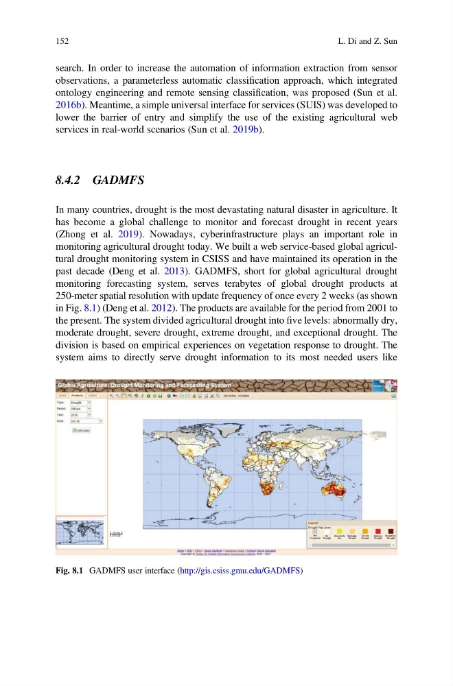
past decade (Deng et al. 2013). GADMFS, short for global agricultural drought
monitoring forecasting system, serves terabytes of global drought products at
250-meter spatial resolution with update frequency of once every 2 weeks (as shown
in Fig. 8.1) (Deng et al. 2012). The products are available for the period from 2001 to
the present. The system divided agricultural drought into five levels: abnormally dry,
moderate drought, severe drought, extreme drought, and exceptional drought. The
division is based on empirical experiences on vegetation response to drought. The
system aims to directly serve drought information to its most needed users like
Fig. 8.1 GADMFS user interface (http://gis.csiss.gmu.edu/GADMFS)
152
L. Di and Z. Sun
observations, a parameterless automatic classification approach, which integrated
ontology engineering and remote sensing classification, was proposed (Sun et al.
2016b). Meantime, a simple universal interface for services (SUIS) was developed to
lower the barrier of entry and simplify the use of the existing agricultural web
services in real-world scenarios (Sun et al. 2019b).
8.4.2 GADMFS
In many countries, drought is the most devastating natural disaster in agriculture. It
has become a global challenge to monitor and forecast drought in recent years
(Zhong et al. 2019). Nowadays, cyberinfrastructure plays an important role in
monitoring agricultural drought today. We built a web service-based global agricultural drought monitoring system in CSISS and have maintained its operation in the
past decade (Deng et al. 2013). GADMFS, short for global agricultural drought
monitoring forecasting system, serves terabytes of global drought products at
250-meter spatial resolution with update frequency of once every 2 weeks (as shown
in Fig. 8.1) (Deng et al. 2012). The products are available for the period from 2001 to
the present. The system divided agricultural drought into five levels: abnormally dry,
moderate drought, severe drought, extreme drought, and exceptional drought. The
division is based on empirical experiences on vegetation response to drought. The
system aims to directly serve drought information to its most needed users like
Fig. 8.1 GADMFS user interface (http://gis.csiss.gmu.edu/GADMFS)
152
L. Di and Z. Sun