

60
C.T. Koulibaly, J.O. Ayoade
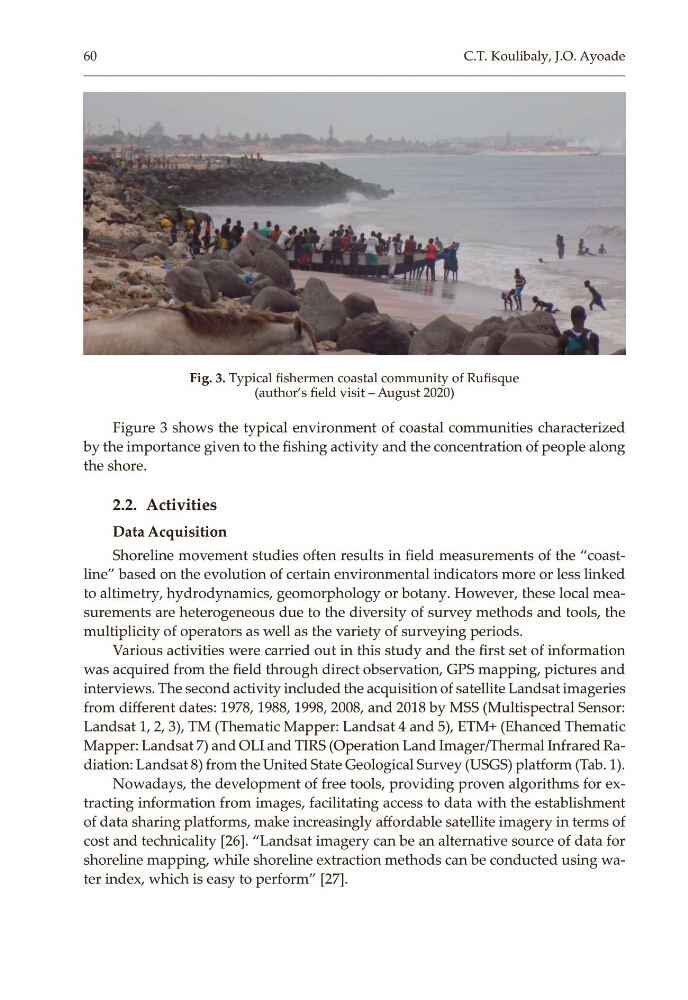
Figure 3 shows the typical environment of coastal communities characterized
by the importance given to the fishing activity and the concentration of people along
the shore.
2.2. Activities
Data Acquisition
Shoreline movement studies often results in field measurements of the “coast‑
line” based on the evolution of certain environmental indicators more or less linked
to altimetry, hydrodynamics, geomorphology or botany. However, these local mea‑
surements are heterogeneous due to the diversity of survey methods and tools, the
multiplicity of operators as well as the variety of surveying periods.
Various activities were carried out in this study and the first set of information
was acquired from the field through direct observation, GPS mapping, pictures and
interviews. The second activity included the acquisition of satellite Landsat imageries
from different dates: 1978, 1988, 1998, 2008, and 2018 by MSS (Multispectral Sensor:
Landsat 1, 2, 3), TM (Thematic Mapper: Landsat 4 and 5), ETM+ (Ehanced Thematic
Mapper: Landsat 7) and OLI and TIRS (Operation Land Imager/Thermal Infrared Ra‑
diation: Landsat 8) from the United State Geological Survey (USGS) platform (Tab. 1).
Nowadays, the development of free tools, providing proven algorithms for ex‑
tracting information from images, facilitating access to data with the establishment
of data sharing platforms, make increasingly affordable satellite imagery in terms of
cost and technicality [26]. “Landsat imagery can be an alternative source of data for
shoreline mapping, while shoreline extraction methods can be conducted using wa‑
ter index, which is easy to perform” [27].
Fig. 3. Typical fishermen coastal community of Rufisque
(author’s field visit – August 2020)
C.T. Koulibaly, J.O. Ayoade
Figure 3 shows the typical environment of coastal communities characterized
by the importance given to the fishing activity and the concentration of people along
the shore.
2.2. Activities
Data Acquisition
Shoreline movement studies often results in field measurements of the “coast‑
line” based on the evolution of certain environmental indicators more or less linked
to altimetry, hydrodynamics, geomorphology or botany. However, these local mea‑
surements are heterogeneous due to the diversity of survey methods and tools, the
multiplicity of operators as well as the variety of surveying periods.
Various activities were carried out in this study and the first set of information
was acquired from the field through direct observation, GPS mapping, pictures and
interviews. The second activity included the acquisition of satellite Landsat imageries
from different dates: 1978, 1988, 1998, 2008, and 2018 by MSS (Multispectral Sensor:
Landsat 1, 2, 3), TM (Thematic Mapper: Landsat 4 and 5), ETM+ (Ehanced Thematic
Mapper: Landsat 7) and OLI and TIRS (Operation Land Imager/Thermal Infrared Ra‑
diation: Landsat 8) from the United State Geological Survey (USGS) platform (Tab. 1).
Nowadays, the development of free tools, providing proven algorithms for ex‑
tracting information from images, facilitating access to data with the establishment
of data sharing platforms, make increasingly affordable satellite imagery in terms of
cost and technicality [26]. “Landsat imagery can be an alternative source of data for
shoreline mapping, while shoreline extraction methods can be conducted using wa‑
ter index, which is easy to perform” [27].
Fig. 3. Typical fishermen coastal community of Rufisque
(author’s field visit – August 2020)