

3. Sédiment Transport
71
13.18513.18
13.17513.17
13.165
13.1613.155
13.15
13.13580.3 80305 80.31 80315 8032 80325 8033 80335 80.34 80.345 80.35 80355
ROYAPURAM
COAST
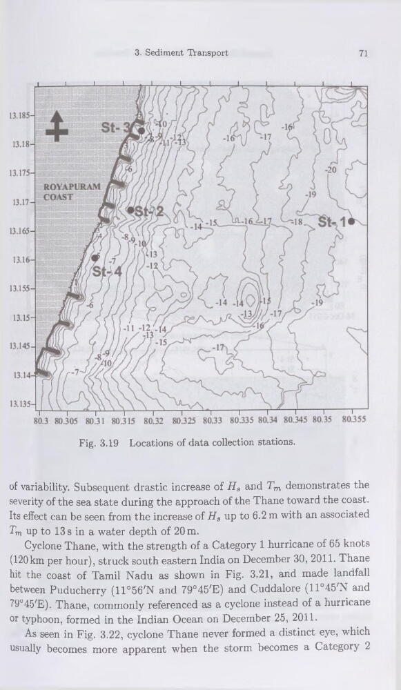
Fig. 3.19 Locations of data collection stations.
of variability. Subséquent drastic increase of Hs and Tm demonstrates the
severity of the sea State during the approach of the Thane toward the coast.
Its effect can be seen from the increase of Hs up to 6.2 m with an associated
Tm up to 13 s in a water depth of 20 m.
Cyclone Thane, with the strength of a Category 1 hurricane of 65 knots
(120km per hour), struck south eastern India on December 30, 2011. Thane
hit the coast of Tamil Nadu as shown in Fig. 3.21, and made landfall
between Puducherry (U°56'N and 79°45'E) and Cuddalore (11°45'N and
79°45ZE). Thane, commonly referenced as a cyclone instead of a hurricane
or typhoon, formed in the Indian Océan on December 25, 2011.
As seen in Fig. 3.22, cyclone Thane never formed a distinct eye, which
usually becomes more apparent when the storm becomes a Category 2
71
13.18513.18
13.17513.17
13.165
13.1613.155
13.15
13.13580.3 80305 80.31 80315 8032 80325 8033 80335 80.34 80.345 80.35 80355
ROYAPURAM
COAST
Fig. 3.19 Locations of data collection stations.
of variability. Subséquent drastic increase of Hs and Tm demonstrates the
severity of the sea State during the approach of the Thane toward the coast.
Its effect can be seen from the increase of Hs up to 6.2 m with an associated
Tm up to 13 s in a water depth of 20 m.
Cyclone Thane, with the strength of a Category 1 hurricane of 65 knots
(120km per hour), struck south eastern India on December 30, 2011. Thane
hit the coast of Tamil Nadu as shown in Fig. 3.21, and made landfall
between Puducherry (U°56'N and 79°45'E) and Cuddalore (11°45'N and
79°45ZE). Thane, commonly referenced as a cyclone instead of a hurricane
or typhoon, formed in the Indian Océan on December 25, 2011.
As seen in Fig. 3.22, cyclone Thane never formed a distinct eye, which
usually becomes more apparent when the storm becomes a Category 2