

154
Coastal Engineering: Theory and Practice
prevent the sand bar formation and to establish a smooth flow of water
from the river into the océan. The location map of the proposed site is
shown in Fig. 4.34.
Based on the field studies of hydrographie and océanographie data collection, nearshore data, satellite imageries and shoreline changes it was
decided to achieve equilibrium by structural means. The proposed measure should also beneficially satisfy the needs of the fishermen community,
where, it could also alleviate maneuvering problems of fishing boats.
The canal mouth on the Southern side of the creek (near the creek
mouth) was found to be fully blocked by the formation of sand bars. This
is clearly due to the prédominant southerly drift. In addition, perennial sand
déposition on the northern banks near the mouth was noticed. This may be
due to the northerly sédiment drift in the océan. Based on analyzing these
conditions, the alignment of training walls had been decided. The length of
the northern training wall is 0.833 km extending up to a water depth of 5 m
and the Southern training wall is 0.803 km long extending up to a water
depth of 4 m. One of the training walls was inclined in order to achieve
adéquate discharge velocity to flush the sand bar also to bypass the littoral
drift. The variations of the shoreline adjoining the pair of training walls
near the mouth of Cheruvathur creek prior and after the implémentation
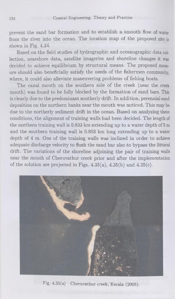
of the solution are projected in Figs. 4.35(a), 4.35(b) and 4.35(c).
Fig. 4.35(a) Cheruvathur creek, Kérala (2005).
Coastal Engineering: Theory and Practice
prevent the sand bar formation and to establish a smooth flow of water
from the river into the océan. The location map of the proposed site is
shown in Fig. 4.34.
Based on the field studies of hydrographie and océanographie data collection, nearshore data, satellite imageries and shoreline changes it was
decided to achieve equilibrium by structural means. The proposed measure should also beneficially satisfy the needs of the fishermen community,
where, it could also alleviate maneuvering problems of fishing boats.
The canal mouth on the Southern side of the creek (near the creek
mouth) was found to be fully blocked by the formation of sand bars. This
is clearly due to the prédominant southerly drift. In addition, perennial sand
déposition on the northern banks near the mouth was noticed. This may be
due to the northerly sédiment drift in the océan. Based on analyzing these
conditions, the alignment of training walls had been decided. The length of
the northern training wall is 0.833 km extending up to a water depth of 5 m
and the Southern training wall is 0.803 km long extending up to a water
depth of 4 m. One of the training walls was inclined in order to achieve
adéquate discharge velocity to flush the sand bar also to bypass the littoral
drift. The variations of the shoreline adjoining the pair of training walls
near the mouth of Cheruvathur creek prior and after the implémentation
of the solution are projected in Figs. 4.35(a), 4.35(b) and 4.35(c).
Fig. 4.35(a) Cheruvathur creek, Kérala (2005).