

S.S. Jacobs, C.F. Giulivi
10
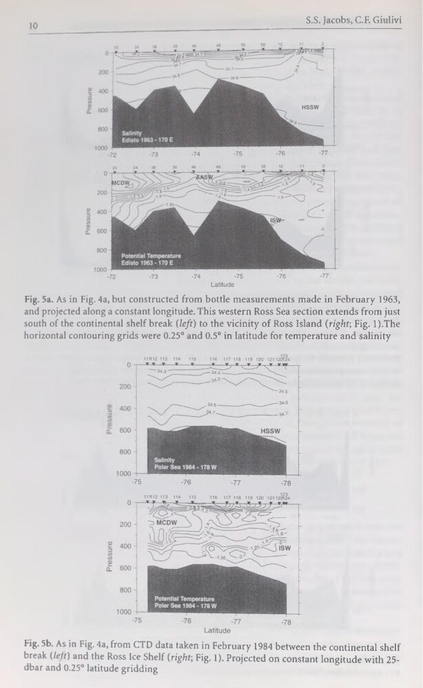
Fig. 5a. As in Fig. 4a, but constructed from bottle measurements made in February 1963,
and projected along a constant longitude. This western Ross Sea section extends from just
south of the continental shelf break (left) to the vicinity of Ross Island (right; Fig. l).The
horizontal contouring grids were 0.25° and 0.5° in latitude for température and salinity
Fig. 5b. As in Fig. 4a, from CTD data taken in February 1984 between the continental shelf
break (/e/t) and the Ross Ice Shelf (right-, Fig. 1). Projected on constant longitude with 25dbar and 0.25° latitude gridding
10
Fig. 5a. As in Fig. 4a, but constructed from bottle measurements made in February 1963,
and projected along a constant longitude. This western Ross Sea section extends from just
south of the continental shelf break (left) to the vicinity of Ross Island (right; Fig. l).The
horizontal contouring grids were 0.25° and 0.5° in latitude for température and salinity
Fig. 5b. As in Fig. 4a, from CTD data taken in February 1984 between the continental shelf
break (/e/t) and the Ross Ice Shelf (right-, Fig. 1). Projected on constant longitude with 25dbar and 0.25° latitude gridding