

oceanographers had carefully lowered drifters into
the water by cranes from stationary research vessels. These devices usually weighed several hundred pounds, and they could not easily be shipped
or deployed into remote areas on a routine basis.
A rugged miniaturization of the drifters was
required so they could be easily deployed by one
deck hand from the fantail of a Volunteer Observing Ship (VOS). These drifters would have to survive a free-fall of 30 feet (ϳ10 m) to the water
surface into the wake of a large cargo ship that
was travelling at 20–30 knots.
Oceanographers had to extend the operational
life of a drifter at sea several times over what was
commonly the case in the early 1980s. The wavetossed ocean surface is a corrosive and stressful
environment where drifters would usually break
within several months. Why drifters were failing
was a question that could only be answered by
recovering significant numbers after they had been
at sea for periods of time.
The costs of returning data from the ARGOS
satellite location system and distributing it to users
had to be reduced by a large factor. The management costs of the satellite data system for locating
drifters could not be afforded by a programme of
the scope contemplated by the WCRP planners.
And a centre had to be established for quickly
distributing the data to both the research and the
operational communities of scientists.
In 1987, a small team of scientists, supported
by the Tropical Ocean and Global Atmosphere
Programme (TOGA) of WCRP, set out to obtain
an instrumental record of the world’s ocean surface circulation. They embarked upon the ambitious programme to design, calibrate, deploy and
distribute data from a global array of lightweight,
low-cost drifters (WCRP, 1988c). The first objective, to measure the currents of the tropical Pacific
Ocean, was accomplished (Niiler, 1995). A Drifter
Data Center was established at the Atlantic
Oceanographic and Meteorological Laboratory
(AOML in Miami, USA). Then the project was
expanded to a global scale under the sponsorship
of the World Ocean Circulation Experiment
(WOCE) and other scientific programmes, and
between 1991 and 1999, an accurate instrumental
circulation record of the greater part of the global
ocean surface was obtained.
The WOCE scientific plan (WCRP, 1988a)
called for the observations of the annual average
global surface circulation and its variance on a
nominal 5° latitude5° longitude space resolution
with data gathered over a 3- to 5-year time period
in each ocean basin. Wind-driven currents were to
be separated from geostrophic currents. Oceanographers estimated that a minimum of 4500 drifters
would be required to achieve these goals. Since
1988, over 45 scientific projects in 18 countries
contributed resources to this Global Drifter Programme. By the close of the twentieth century, over
4800 calibrated drifters were deployed, achieving
and exceeding the objectives of WOCE. From 1993
onward, an average global array of 700–900
drifters were in the ocean providing data on ocean
currents and sea surface temperature. The raw data
from these drifters is gathered on the ARGOS
system and is distributed with about a 2-h delay on
the Global Telecommunication System (GTS). The
processed data, and the extensive list of scientific
papers that have been published using these data,
can be viewed on the Drifter Data Center web site:
http://www.aoml.noaa.gov/. The Data Buoy Cooperation Panel (DBCP) of the Intergovernmental
Oceanographic Commission (IOC) and the World
Meteorological Organization (WMO) now sponsor
the Global Drifter Programme.
This chapter describes the new drifters and summarizes the global data set of near-surface current
SECTION 4 THE GLOBAL FLOW FIELD
194
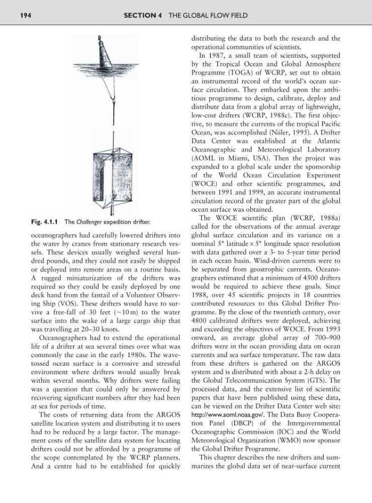
Fig. 4.1.1 The Challenger expedition drifter.
the water by cranes from stationary research vessels. These devices usually weighed several hundred pounds, and they could not easily be shipped
or deployed into remote areas on a routine basis.
A rugged miniaturization of the drifters was
required so they could be easily deployed by one
deck hand from the fantail of a Volunteer Observing Ship (VOS). These drifters would have to survive a free-fall of 30 feet (ϳ10 m) to the water
surface into the wake of a large cargo ship that
was travelling at 20–30 knots.
Oceanographers had to extend the operational
life of a drifter at sea several times over what was
commonly the case in the early 1980s. The wavetossed ocean surface is a corrosive and stressful
environment where drifters would usually break
within several months. Why drifters were failing
was a question that could only be answered by
recovering significant numbers after they had been
at sea for periods of time.
The costs of returning data from the ARGOS
satellite location system and distributing it to users
had to be reduced by a large factor. The management costs of the satellite data system for locating
drifters could not be afforded by a programme of
the scope contemplated by the WCRP planners.
And a centre had to be established for quickly
distributing the data to both the research and the
operational communities of scientists.
In 1987, a small team of scientists, supported
by the Tropical Ocean and Global Atmosphere
Programme (TOGA) of WCRP, set out to obtain
an instrumental record of the world’s ocean surface circulation. They embarked upon the ambitious programme to design, calibrate, deploy and
distribute data from a global array of lightweight,
low-cost drifters (WCRP, 1988c). The first objective, to measure the currents of the tropical Pacific
Ocean, was accomplished (Niiler, 1995). A Drifter
Data Center was established at the Atlantic
Oceanographic and Meteorological Laboratory
(AOML in Miami, USA). Then the project was
expanded to a global scale under the sponsorship
of the World Ocean Circulation Experiment
(WOCE) and other scientific programmes, and
between 1991 and 1999, an accurate instrumental
circulation record of the greater part of the global
ocean surface was obtained.
The WOCE scientific plan (WCRP, 1988a)
called for the observations of the annual average
global surface circulation and its variance on a
nominal 5° latitude5° longitude space resolution
with data gathered over a 3- to 5-year time period
in each ocean basin. Wind-driven currents were to
be separated from geostrophic currents. Oceanographers estimated that a minimum of 4500 drifters
would be required to achieve these goals. Since
1988, over 45 scientific projects in 18 countries
contributed resources to this Global Drifter Programme. By the close of the twentieth century, over
4800 calibrated drifters were deployed, achieving
and exceeding the objectives of WOCE. From 1993
onward, an average global array of 700–900
drifters were in the ocean providing data on ocean
currents and sea surface temperature. The raw data
from these drifters is gathered on the ARGOS
system and is distributed with about a 2-h delay on
the Global Telecommunication System (GTS). The
processed data, and the extensive list of scientific
papers that have been published using these data,
can be viewed on the Drifter Data Center web site:
http://www.aoml.noaa.gov/. The Data Buoy Cooperation Panel (DBCP) of the Intergovernmental
Oceanographic Commission (IOC) and the World
Meteorological Organization (WMO) now sponsor
the Global Drifter Programme.
This chapter describes the new drifters and summarizes the global data set of near-surface current
SECTION 4 THE GLOBAL FLOW FIELD
194
Fig. 4.1.1 The Challenger expedition drifter.