

Swamgir-1 (June 1999) campaigns. Data were treated with the ArcView GIS
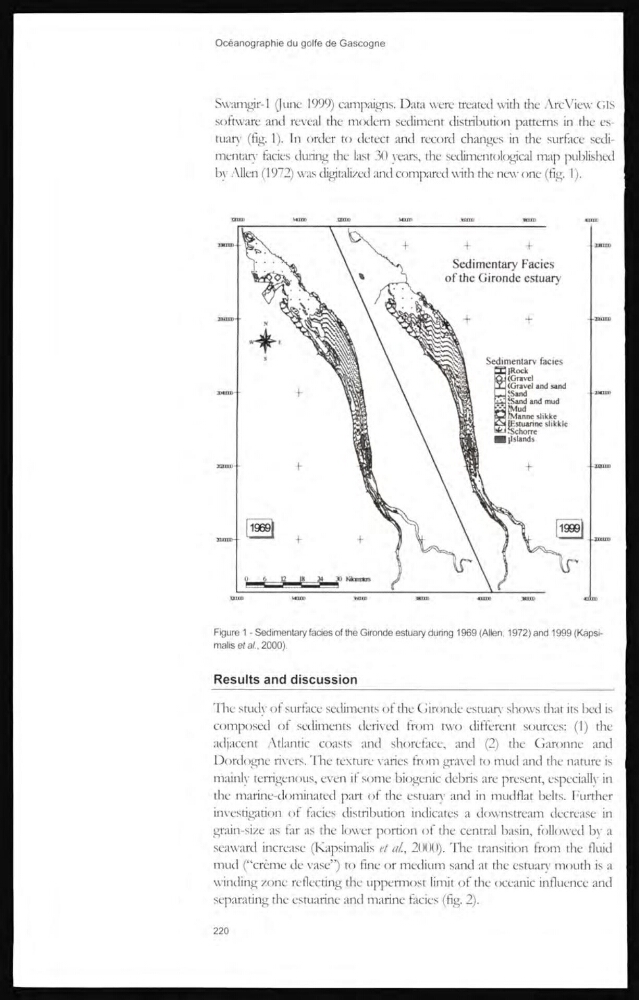
software and reveal the modem sediment distribution pattems in the estuary (fig. 1). In order to detect and record changes in the surface sedimentary facies during the last 30 years, the sedimentological map published
by Allen (1972) was digitalized and compared with the new one (fig. 1).
Figure 1 - Sedimentary facies of the Gironde estuary during 1969 (Allen, 1972) and 1999 (Kapsimalis eta/., 2000).
Results and discussion
The study of surface sediments of the Gironde estuary shows that its bed is
composed of sediments derived from two different sources: (1) the
adjacent Atlantic coasts and shoreface, and (2) the Garonne and
Dordogne rivers. The texture varies from gravel to mud and the nature is
mainly terrigenous, even if some biogenic debris are present, especially in
tlie marine-dominated part of the estuary and in mudflat belts. Further
invesrigation of facies distribution indicates a downstream decrease in
grain-size as far as the lower portion of the central basin, followed by a
seaward increase (Kapsimalis et al., 2000). The transition from the fluid
mud (“crème de vase”) to fine or medium sand at the cstuary mouth is a
uinding zone reflecting the uppermost limit of the oceanic influence and
separating the estuarine and marine facies (fig. 2).
220
software and reveal the modem sediment distribution pattems in the estuary (fig. 1). In order to detect and record changes in the surface sedimentary facies during the last 30 years, the sedimentological map published
by Allen (1972) was digitalized and compared with the new one (fig. 1).
Figure 1 - Sedimentary facies of the Gironde estuary during 1969 (Allen, 1972) and 1999 (Kapsimalis eta/., 2000).
Results and discussion
The study of surface sediments of the Gironde estuary shows that its bed is
composed of sediments derived from two different sources: (1) the
adjacent Atlantic coasts and shoreface, and (2) the Garonne and
Dordogne rivers. The texture varies from gravel to mud and the nature is
mainly terrigenous, even if some biogenic debris are present, especially in
tlie marine-dominated part of the estuary and in mudflat belts. Further
invesrigation of facies distribution indicates a downstream decrease in
grain-size as far as the lower portion of the central basin, followed by a
seaward increase (Kapsimalis et al., 2000). The transition from the fluid
mud (“crème de vase”) to fine or medium sand at the cstuary mouth is a
uinding zone reflecting the uppermost limit of the oceanic influence and
separating the estuarine and marine facies (fig. 2).
220