

CoastGIS'99: geomatics and coastal environment
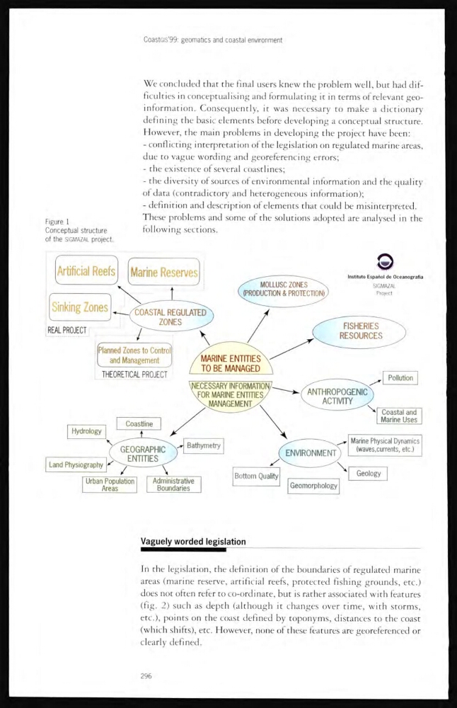
Figure 1
Conceptual structure
of the SIGMAZAL p'roject.
We concluded that the final users knew the problem well, but had difi
ficulties in conceptualising and formulating it in terms of relevant geoinformation. Consequently, it was necessary to make a dictionary
defining the basic elemenrs before developing a conceptual structure.
However, the main problems in developing the project have been:
- conflicting interpretation of the legislation on regulated marine areas,
due to vague wording and georeferencing errors;
- the existence of several coastlines;
- the diversity of sources of environmental information and the quality
of data (contradictory and heterogeneous information);
- definition and description of elements that could be misinterpreted.
These problems and some of the solutions adopred are analysed in the
following sections.
Vaguely worded legislation
In the legislation, the definition of the boundaries of regulated marine
areas (marine reserve, artificial reefs, protected fishing grounds, etc.)
does not often refer to co-ordinate, but is rather associated with features
(fig. 2) such as depth (although it changes over time, with storms,
etc.), points on the coast defined by toponyms, distances to the coast
(which shifts), etc. However, none of these features are georeferenced or
clearly defined.
296
Figure 1
Conceptual structure
of the SIGMAZAL p'roject.
We concluded that the final users knew the problem well, but had difi
ficulties in conceptualising and formulating it in terms of relevant geoinformation. Consequently, it was necessary to make a dictionary
defining the basic elemenrs before developing a conceptual structure.
However, the main problems in developing the project have been:
- conflicting interpretation of the legislation on regulated marine areas,
due to vague wording and georeferencing errors;
- the existence of several coastlines;
- the diversity of sources of environmental information and the quality
of data (contradictory and heterogeneous information);
- definition and description of elements that could be misinterpreted.
These problems and some of the solutions adopred are analysed in the
following sections.
Vaguely worded legislation
In the legislation, the definition of the boundaries of regulated marine
areas (marine reserve, artificial reefs, protected fishing grounds, etc.)
does not often refer to co-ordinate, but is rather associated with features
(fig. 2) such as depth (although it changes over time, with storms,
etc.), points on the coast defined by toponyms, distances to the coast
(which shifts), etc. However, none of these features are georeferenced or
clearly defined.
296