

118
A. D. BONEY
of coastline in a survey of Mull, Skye, Ross-shire and Sutherland. Such
harvestable areas were lacking from the north, north-east and east
coasts of Scotland. The detailed estimates made on the harvestable
areas included also information on the substratum and angle of slope
of the shore, and on the relative frequency of the common rockweeds
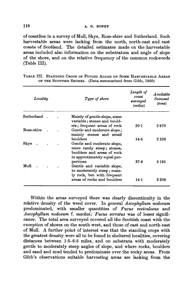
(Table 111).
TABLE 111. STANDING CROPS OB FUCOID ALGAE ON SOME HARVESTABLE AREAS
OF THE SCOTTISH SHORES. (Data summarized from Gibb, 1950)
Locality
Length Of
Avai/&le
Seaweed
comt
Type of shore
surveyed
(mil@)
( t o m )
Sutherland .
Mainly of gentle slope, some
variable ; stones and boulders; frequent areas of rock
20.1
2 870
Ross-shire .
Gentle and moderate slope ;
mainly stones and small
boulders
14.5
2 326
Skye .
Gentle and moderate slope,
more rarely steep; stones,
boulders and areas of rock
in approximately equal proMull .
Gentle and variable slope,
to moderately steep ; mainly rock, but with frequent
a r e a of rocks and boulders
14.1
2 328
portions
37.8
5 191
Within the areas surveyed there was clearly discontinuity in the
relative density of the weed cover. In general Ascophyllum nodosum
predominated, with smaller quantities of Fucus vesiculosus and
Ascophyllum nodosum f. mackai; Fucus serratus was of lesser significance. The total area surveyed covered all the Scottish coast with the
exception of shores on the south-west, and those of east and north-east
of Mull. A further point of interest was that the standing crops with
the greatest density were all to be found in sheltered localities, covering
distances between 1.5-6.5 miles, and on substrata with moderately
gentle to moderately steep angles of slope, and where rocks, boulders
and sand and mud tended to predominate over the rocky areas. From
Gibb’s observations suitable harvesting areas are lacking from the
A. D. BONEY
of coastline in a survey of Mull, Skye, Ross-shire and Sutherland. Such
harvestable areas were lacking from the north, north-east and east
coasts of Scotland. The detailed estimates made on the harvestable
areas included also information on the substratum and angle of slope
of the shore, and on the relative frequency of the common rockweeds
(Table 111).
TABLE 111. STANDING CROPS OB FUCOID ALGAE ON SOME HARVESTABLE AREAS
OF THE SCOTTISH SHORES. (Data summarized from Gibb, 1950)
Locality
Length Of
Avai/&le
Seaweed
comt
Type of shore
surveyed
(mil@)
( t o m )
Sutherland .
Mainly of gentle slope, some
variable ; stones and boulders; frequent areas of rock
20.1
2 870
Ross-shire .
Gentle and moderate slope ;
mainly stones and small
boulders
14.5
2 326
Skye .
Gentle and moderate slope,
more rarely steep; stones,
boulders and areas of rock
in approximately equal proMull .
Gentle and variable slope,
to moderately steep ; mainly rock, but with frequent
a r e a of rocks and boulders
14.1
2 328
portions
37.8
5 191
Within the areas surveyed there was clearly discontinuity in the
relative density of the weed cover. In general Ascophyllum nodosum
predominated, with smaller quantities of Fucus vesiculosus and
Ascophyllum nodosum f. mackai; Fucus serratus was of lesser significance. The total area surveyed covered all the Scottish coast with the
exception of shores on the south-west, and those of east and north-east
of Mull. A further point of interest was that the standing crops with
the greatest density were all to be found in sheltered localities, covering
distances between 1.5-6.5 miles, and on substrata with moderately
gentle to moderately steep angles of slope, and where rocks, boulders
and sand and mud tended to predominate over the rocky areas. From
Gibb’s observations suitable harvesting areas are lacking from the