

CHAPTER 19 Earth’s Evolution through Geologic Time
476
span because the rock formations are more
widespread and less disturbed than those of
any preceding era.
Most of North America was above
sea level during the Cenozoic era.
However, the eastern and western margins
of the continent experienced markedly
contrasting events because of their
different plate boundary relationships.
The Atlantic and Gulf coastal regions, far
removed from an active plate boundary,
were tectonically stable. By contrast,
western North America was the leading
edge of the North American plate. As a
result, plate interactions during the
Cenozoic account for many events of
mountain building, volcanism, and
earthquakes.
EASTERN NORTH AMERICA. The stable
continental margin of eastern North
America was the site of abundant marine
sedimentation. The most extensive deposition surrounded the Gulf of Mexico, from
the Yucatan Peninsula to Florida, where a
massive buildup of sediment caused the
crust to downwarp. In many instances,
faulting created structures in which oil and
natural gas accumulated. Today, these and
other petroleum traps are the Gulf Coast’ s
most economically important resource,
evidenced by numerous offshore drilling
platforms.
By early Cenozoic time, most of the
original Appalachians had eroded to create
a low plain. Later, isostatic adjustments
again raised the region and rejuvenated its
rivers. Streams eroded with renewed vigor,
gradually sculpting the surface into its
present-day topography. Sediments from
this erosion were deposited along the
eastern continental margin, where they
accumulated to a thickness of many
kilometers. Today, portions of the strata
deposited during the Cenozoic are exposed
as the gently sloping Atlantic and Gulf
coastal plains, where a large percentage of
the eastern and southeastern United States
population resides.
WESTERN NORTH AMERICA. In the
West, the Laramide Orogeny responsible
for building the southern Rocky Mountains
was coming to an end. As erosional forces
lowered the mountains, the basins between
uplifted ranges began to fill with sediment.
East of the Rockies, a large wedge of
sediment from the eroding mountains
created the Great Plains.
Beginning in the Miocene epoch about
20 million years ago, a broad region from
northern Nevada into Mexico experienced
crustal extension that created more than
150 fault-block mountain ranges. Today,
they rise abruptly above the adjacent
basins, creating the Basin and Range
Province (see Chapter 17).
As the Basin and Range Province was
developing, the entire western interior of
the continent gradually uplifted. This event
reelevated the Rockies and rejuvenated
many of the West’ s major rivers. As the
rivers became incised, many spectacular
gorges were created, including the
Grand Canyon of the Colorado River, the
Grand Canyon of the Snake River, and
the Black Canyon of the Gunnison River.
Volcanic activity was also common in
the West during much of the Cenozoic.
Beginning in the Miocene epoch, great
volumes of fluid basaltic lava flowed from
fissures in portions of present-day
Washington, Oregon, and Idaho. These
eruptions built the extensive (1.3 million
square miles) Columbia Plateau.
Immediately west of the Columbia Plateau,
volcanic activity was different in character.
Here, more viscous magmas with higher
silica content erupted explosively, creating
the Cascades, a chain of stratovolcanoes
extending from northern California into
Canada, some of which are still active
(FIGURE 19.20).
A final episode of deformation
occurred in the late Cenozoic, creating the
Coast Ranges that stretch along the Pacific
Coast. Meanwhile, the Sierra Nevada were
faulted and uplifted along their eastern
flank, forming the impressive mountains
we see today.
As the Cenozoic was drawing to a close,
the effects of mountain building, volcanic
activity, isostatic adjustments, and extensive
erosion and sedimentation created the physical landscape we know today. All that
remained of Cenozoic time was the
final 2.6-million-year episode
called the Quaternary
period. During this
most recent, and
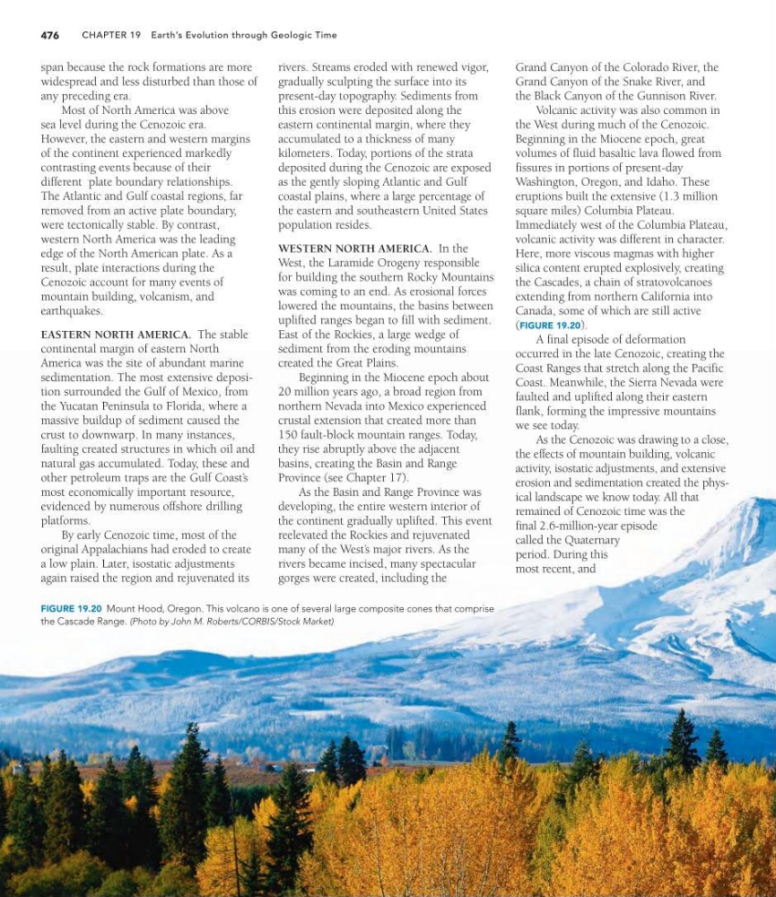
FIGURE 19.20 Mount Hood, Oregon. This volcano is one of several large composite cones that comprise
the Cascade Range. (Photo by John M. Roberts/CORBIS/Stock Market)
476
span because the rock formations are more
widespread and less disturbed than those of
any preceding era.
Most of North America was above
sea level during the Cenozoic era.
However, the eastern and western margins
of the continent experienced markedly
contrasting events because of their
different plate boundary relationships.
The Atlantic and Gulf coastal regions, far
removed from an active plate boundary,
were tectonically stable. By contrast,
western North America was the leading
edge of the North American plate. As a
result, plate interactions during the
Cenozoic account for many events of
mountain building, volcanism, and
earthquakes.
EASTERN NORTH AMERICA. The stable
continental margin of eastern North
America was the site of abundant marine
sedimentation. The most extensive deposition surrounded the Gulf of Mexico, from
the Yucatan Peninsula to Florida, where a
massive buildup of sediment caused the
crust to downwarp. In many instances,
faulting created structures in which oil and
natural gas accumulated. Today, these and
other petroleum traps are the Gulf Coast’ s
most economically important resource,
evidenced by numerous offshore drilling
platforms.
By early Cenozoic time, most of the
original Appalachians had eroded to create
a low plain. Later, isostatic adjustments
again raised the region and rejuvenated its
rivers. Streams eroded with renewed vigor,
gradually sculpting the surface into its
present-day topography. Sediments from
this erosion were deposited along the
eastern continental margin, where they
accumulated to a thickness of many
kilometers. Today, portions of the strata
deposited during the Cenozoic are exposed
as the gently sloping Atlantic and Gulf
coastal plains, where a large percentage of
the eastern and southeastern United States
population resides.
WESTERN NORTH AMERICA. In the
West, the Laramide Orogeny responsible
for building the southern Rocky Mountains
was coming to an end. As erosional forces
lowered the mountains, the basins between
uplifted ranges began to fill with sediment.
East of the Rockies, a large wedge of
sediment from the eroding mountains
created the Great Plains.
Beginning in the Miocene epoch about
20 million years ago, a broad region from
northern Nevada into Mexico experienced
crustal extension that created more than
150 fault-block mountain ranges. Today,
they rise abruptly above the adjacent
basins, creating the Basin and Range
Province (see Chapter 17).
As the Basin and Range Province was
developing, the entire western interior of
the continent gradually uplifted. This event
reelevated the Rockies and rejuvenated
many of the West’ s major rivers. As the
rivers became incised, many spectacular
gorges were created, including the
Grand Canyon of the Colorado River, the
Grand Canyon of the Snake River, and
the Black Canyon of the Gunnison River.
Volcanic activity was also common in
the West during much of the Cenozoic.
Beginning in the Miocene epoch, great
volumes of fluid basaltic lava flowed from
fissures in portions of present-day
Washington, Oregon, and Idaho. These
eruptions built the extensive (1.3 million
square miles) Columbia Plateau.
Immediately west of the Columbia Plateau,
volcanic activity was different in character.
Here, more viscous magmas with higher
silica content erupted explosively, creating
the Cascades, a chain of stratovolcanoes
extending from northern California into
Canada, some of which are still active
(FIGURE 19.20).
A final episode of deformation
occurred in the late Cenozoic, creating the
Coast Ranges that stretch along the Pacific
Coast. Meanwhile, the Sierra Nevada were
faulted and uplifted along their eastern
flank, forming the impressive mountains
we see today.
As the Cenozoic was drawing to a close,
the effects of mountain building, volcanic
activity, isostatic adjustments, and extensive
erosion and sedimentation created the physical landscape we know today. All that
remained of Cenozoic time was the
final 2.6-million-year episode
called the Quaternary
period. During this
most recent, and
FIGURE 19.20 Mount Hood, Oregon. This volcano is one of several large composite cones that comprise
the Cascade Range. (Photo by John M. Roberts/CORBIS/Stock Market)