

54
Chapter 3 Getting Your Data to Match the Map
An ongoing project for the collection and preservation of old historic maps on the part of David
Rumsey can be seen at http://www.davidrumsey.
com. The maps on the Website are part of a collection stretching from the seventeenth through
the twentieth century. While there are many ways
of viewing these maps, some of the historic maps
have been georeferenced to make them match up
with current geospatial imagery. By looking at georeferenced maps in relation to current data, you
can see how areas have changed over time. On
the Website, select the link for Google Earth under the Quicklinks section, then select the option
to View Google Earth in your Web browser (you’ll
have to install a Google plug-in to make this work
properly). Inside your Web browser, you’ll be able
David Rumsey Historical Map Collection
roads and neighborhoods, so people can get to your meeting. The problem is
that while the data you have of the surrounding area (whether aerial photos,
satellite imagery, or GIS data layers) contains real-world spatial references,
your downloaded map is just a graphic or PDF without any spatial reference at
all. Thus, the campus map won’t match up with the spatially referenced data,
and your plan of a snappy geospatial-style invitation is ruined. However, if you
could just georeference that campus map, everything would fit together. The
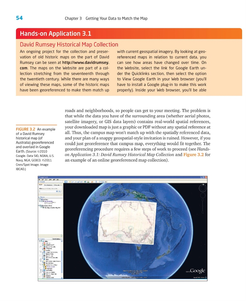
georeferencing procedure requires a few steps of work to proceed (see Handson Application 3.1: David Rumsey Historical Map Collection and Figure 3.2 for
an example of an online georeferenced map collection).
FIGURE 3.2 An example
of a David Rumsey
historical map (of
Australia) georeferenced
and overlaid in Google
Earth. (Source: ©2010
Google. Data SIO, NOAA, U.S.
Navy, NGA, GEBCO. ©2011
Cnes/Spot Image. Image
IBCAO.)
Hands-on Application 3.1
Chapter 3 Getting Your Data to Match the Map
An ongoing project for the collection and preservation of old historic maps on the part of David
Rumsey can be seen at http://www.davidrumsey.
com. The maps on the Website are part of a collection stretching from the seventeenth through
the twentieth century. While there are many ways
of viewing these maps, some of the historic maps
have been georeferenced to make them match up
with current geospatial imagery. By looking at georeferenced maps in relation to current data, you
can see how areas have changed over time. On
the Website, select the link for Google Earth under the Quicklinks section, then select the option
to View Google Earth in your Web browser (you’ll
have to install a Google plug-in to make this work
properly). Inside your Web browser, you’ll be able
David Rumsey Historical Map Collection
roads and neighborhoods, so people can get to your meeting. The problem is
that while the data you have of the surrounding area (whether aerial photos,
satellite imagery, or GIS data layers) contains real-world spatial references,
your downloaded map is just a graphic or PDF without any spatial reference at
all. Thus, the campus map won’t match up with the spatially referenced data,
and your plan of a snappy geospatial-style invitation is ruined. However, if you
could just georeference that campus map, everything would fit together. The
georeferencing procedure requires a few steps of work to proceed (see Handson Application 3.1: David Rumsey Historical Map Collection and Figure 3.2 for
an example of an online georeferenced map collection).
FIGURE 3.2 An example
of a David Rumsey
historical map (of
Australia) georeferenced
and overlaid in Google
Earth. (Source: ©2010
Google. Data SIO, NOAA, U.S.
Navy, NGA, GEBCO. ©2011
Cnes/Spot Image. Image
IBCAO.)
Hands-on Application 3.1