

47
Coordinates and Position Measurements
2.1 Examining Coordinates and Distance
Measurements in Google Earth
1. Start GE. Once Earth settles into view, scroll your mouse around
Earth. You’ll see a set of latitude and longitude coordinates appear at
the bottom of the view representing the coordinates assigned to your
mouse’s location. By default, GE uses the GCS coordinate system and the
WGS84 datum.
2. To examine the full graticule of latitude and longitude lines, from
the View pull-down menu select Grid. Some key GCS lines will be
highlighted in yellow amidst the Web of lat/long lines—the Equator,
Prime Meridian, the Antimeridian, the Tropic of Cancer, and the Tropic
of Capricorn.
3. We’ll begin in Washington, D.C., so in the Fly To box, type Washington,
D.C. GE will rotate and zoom to this area. You’ll also see the spaces
between the lat/long lines grow smaller and new values appear as GE
zooms in.
4. Next, you’ll go a specific location in Washington, D.C. In the Fly To box,
type the following coordinates: 38.897631, −77.036566. These are the
decimal degree lat/long coordinates of the White House.
5. Press the Placemark button on the toolbar (see Geospatial Lab
Application 1.1 for more information on placemarks). The yellow
pushpin will automatically be placed at the lat/long coordinates you
had GE search for (so you don’t have to manually place it anywhere). In
the New Placemark dialog box, type The White House for the name of
the placemark, and select
another symbol for the
yellow pushpin if you want.
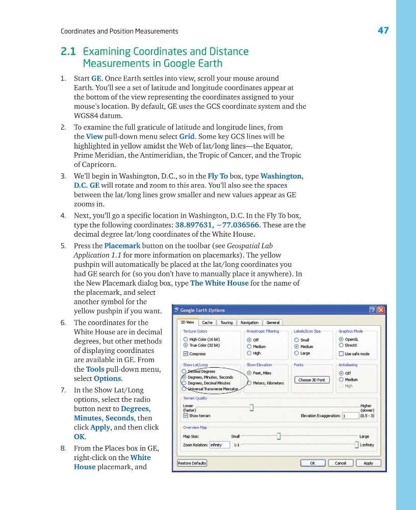
6. The coordinates for the
White House are in decimal
degrees, but other methods
of displaying coordinates
are available in GE. From
the Tools pull-down menu,
select Options.
7. In the Show Lat/Long
options, select the radio
button next to Degrees,
Minutes, Seconds, then
click Apply, and then click
OK.
8. From the Places box in GE,
right-click on the White
House placemark, and
Coordinates and Position Measurements
2.1 Examining Coordinates and Distance
Measurements in Google Earth
1. Start GE. Once Earth settles into view, scroll your mouse around
Earth. You’ll see a set of latitude and longitude coordinates appear at
the bottom of the view representing the coordinates assigned to your
mouse’s location. By default, GE uses the GCS coordinate system and the
WGS84 datum.
2. To examine the full graticule of latitude and longitude lines, from
the View pull-down menu select Grid. Some key GCS lines will be
highlighted in yellow amidst the Web of lat/long lines—the Equator,
Prime Meridian, the Antimeridian, the Tropic of Cancer, and the Tropic
of Capricorn.
3. We’ll begin in Washington, D.C., so in the Fly To box, type Washington,
D.C. GE will rotate and zoom to this area. You’ll also see the spaces
between the lat/long lines grow smaller and new values appear as GE
zooms in.
4. Next, you’ll go a specific location in Washington, D.C. In the Fly To box,
type the following coordinates: 38.897631, −77.036566. These are the
decimal degree lat/long coordinates of the White House.
5. Press the Placemark button on the toolbar (see Geospatial Lab
Application 1.1 for more information on placemarks). The yellow
pushpin will automatically be placed at the lat/long coordinates you
had GE search for (so you don’t have to manually place it anywhere). In
the New Placemark dialog box, type The White House for the name of
the placemark, and select
another symbol for the
yellow pushpin if you want.
6. The coordinates for the
White House are in decimal
degrees, but other methods
of displaying coordinates
are available in GE. From
the Tools pull-down menu,
select Options.
7. In the Show Lat/Long
options, select the radio
button next to Degrees,
Minutes, Seconds, then
click Apply, and then click
OK.
8. From the Places box in GE,
right-click on the White
House placemark, and