

460
Chapter 15 What’s Next for Geospatial Technology?
to a local area (as the topographic maps and imagery cover the whole of the
United States). Similarly, the addresses and analysis of Section 15.4 can be
performed with local landmarks instead of Hollywood ones.
15.1 Getting Started With ArcGIS Explorer
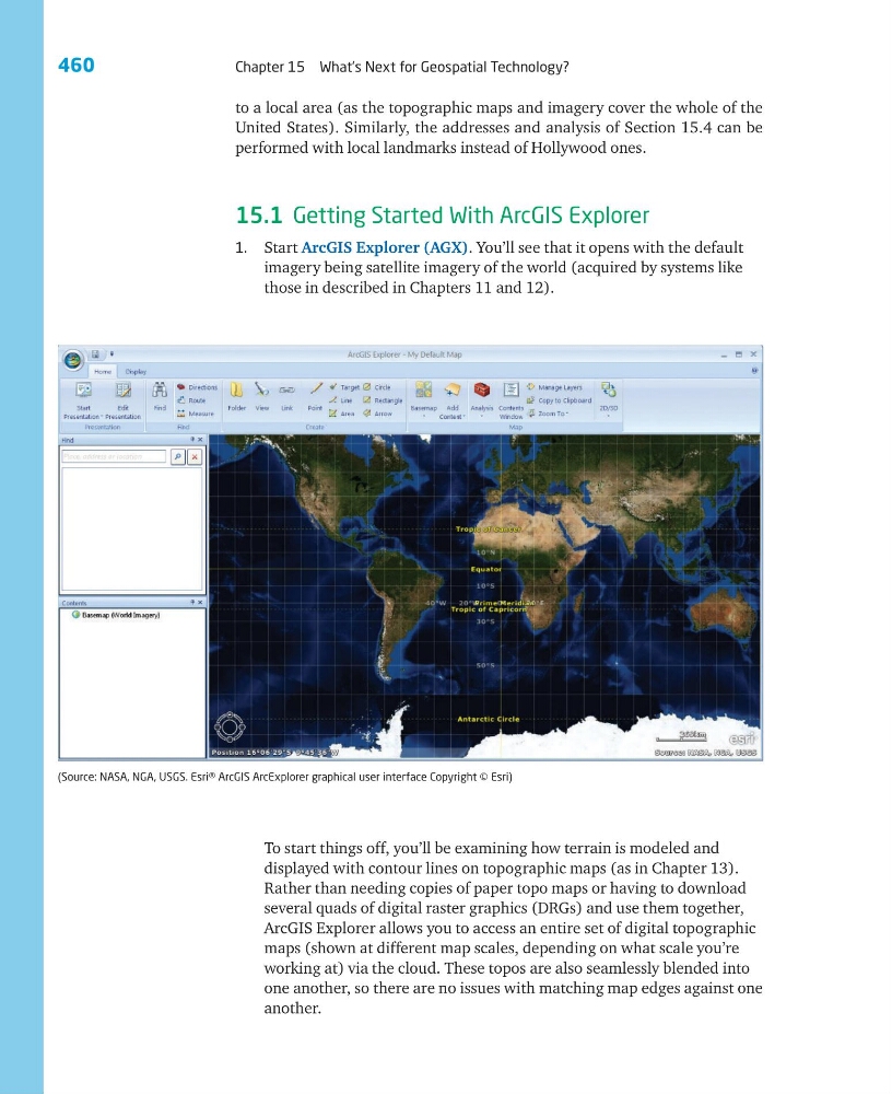
1. Start ArcGIS Explorer (AGX). You’ll see that it opens with the default
imagery being satellite imagery of the world (acquired by systems like
those in described in Chapters 11 and 12).
(Source: NASA, NGA, USGS. Esri® ArcGIS ArcExplorer graphical user interface Copyright © Esri)
To start things off, you’ll be examining how terrain is modeled and
displayed with contour lines on topographic maps (as in Chapter 13).
Rather than needing copies of paper topo maps or having to download
several quads of digital raster graphics (DRGs) and use them together,
ArcGIS Explorer allows you to access an entire set of digital topographic
maps (shown at different map scales, depending on what scale you’re
working at) via the cloud. These topos are also seamlessly blended into
one another, so there are no issues with matching map edges against one
another.
Chapter 15 What’s Next for Geospatial Technology?
to a local area (as the topographic maps and imagery cover the whole of the
United States). Similarly, the addresses and analysis of Section 15.4 can be
performed with local landmarks instead of Hollywood ones.
15.1 Getting Started With ArcGIS Explorer
1. Start ArcGIS Explorer (AGX). You’ll see that it opens with the default
imagery being satellite imagery of the world (acquired by systems like
those in described in Chapters 11 and 12).
(Source: NASA, NGA, USGS. Esri® ArcGIS ArcExplorer graphical user interface Copyright © Esri)
To start things off, you’ll be examining how terrain is modeled and
displayed with contour lines on topographic maps (as in Chapter 13).
Rather than needing copies of paper topo maps or having to download
several quads of digital raster graphics (DRGs) and use them together,
ArcGIS Explorer allows you to access an entire set of digital topographic
maps (shown at different map scales, depending on what scale you’re
working at) via the cloud. These topos are also seamlessly blended into
one another, so there are no issues with matching map edges against one
another.