

451
How Can You Use Geospatial Technology Online?
option puts more mapping choices and geospatial data into the hands of end
users, allowing you to build, design, and customize your own mapping applications, and then embed them onto a Website or e-mail a link to others.
The basis for “Mapping for Everyone” is an available ArcGIS Javascript
(or Flex or Silverlight) API (Application Programming Interface) that you
can use to develop custom applications. Esri makes several samples (such as
base maps or layers, referred to as Map Services) available for free as part
of their online resources so that creating a simple Web-mapping application
is as easy as copying their base code and customizing it. Other companies,
such as Google, Microsoft, and Yahoo!, provide APIs that allow you to embed
In previous chapters, you’ve explored several online mapping applications, whether to perform
queries, build buffers, check color choices, find a
shortest path, or georeference a map. There are
more—a lot more—online mapping sites out there.
For multiple examples, check out some of the ArcGIS Server Live User Sites—open your Web browser
and go to http://www.esri.com/software/arcgis/
arcgisser ver/live-user-sites.html and examine some
of the available maps. Click on a map and a brief
description will appear, along with a link to “View
Live Site” (that is, interact with that particular map
utility itself). Examine several of the Live Sites.
All of these mapping sites linked to this Website
are examples of using ArcGIS Server to construct
Web mapping utilities. What are some of the
functions being mapped and how are they being
implemented?
Hands-on Application 15.7
ArcGIS Server Live User Sites
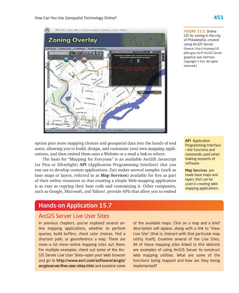
FIGURE 15.5 Online
GIS for zoning in the city
of Philadelphia, created
using ArcGIS Server.
(Source: http://citymaps10.
phila.gov, Esri® ArcGIS Server
graphical user interface
Copyright © Esri. All rights
reserved.)
API Application
Programming Interface
—the functions and
commands used when
making requests of
software.
Map Services premade base maps and
layers that can be
used in creating Webmapping applications.
How Can You Use Geospatial Technology Online?
option puts more mapping choices and geospatial data into the hands of end
users, allowing you to build, design, and customize your own mapping applications, and then embed them onto a Website or e-mail a link to others.
The basis for “Mapping for Everyone” is an available ArcGIS Javascript
(or Flex or Silverlight) API (Application Programming Interface) that you
can use to develop custom applications. Esri makes several samples (such as
base maps or layers, referred to as Map Services) available for free as part
of their online resources so that creating a simple Web-mapping application
is as easy as copying their base code and customizing it. Other companies,
such as Google, Microsoft, and Yahoo!, provide APIs that allow you to embed
In previous chapters, you’ve explored several online mapping applications, whether to perform
queries, build buffers, check color choices, find a
shortest path, or georeference a map. There are
more—a lot more—online mapping sites out there.
For multiple examples, check out some of the ArcGIS Server Live User Sites—open your Web browser
and go to http://www.esri.com/software/arcgis/
arcgisser ver/live-user-sites.html and examine some
of the available maps. Click on a map and a brief
description will appear, along with a link to “View
Live Site” (that is, interact with that particular map
utility itself). Examine several of the Live Sites.
All of these mapping sites linked to this Website
are examples of using ArcGIS Server to construct
Web mapping utilities. What are some of the
functions being mapped and how are they being
implemented?
Hands-on Application 15.7
ArcGIS Server Live User Sites
FIGURE 15.5 Online
GIS for zoning in the city
of Philadelphia, created
using ArcGIS Server.
(Source: http://citymaps10.
phila.gov, Esri® ArcGIS Server
graphical user interface
Copyright © Esri. All rights
reserved.)
API Application
Programming Interface
—the functions and
commands used when
making requests of
software.
Map Services premade base maps and
layers that can be
used in creating Webmapping applications.