

440
Chapter 15 What’s Next for Geospatial Technology?
2006 saw the launch of Earth Observation Day to showcase remote sensing
research and education across the globe.
One of the neatest recent advances is the opportunity for everyday people
(without geospatial training) to get involved in this field. With geospatial tools
becoming increasingly utilized by everyone, people now have the chance to
create their own geospatial content. Whether it’s creating new maps, updating
existing maps, tying digital pictures to locations in Google Earth, or adding to
geocaching databases, people are using geospatial technologies to add to or enhance geospatial data and knowledge. Dr. Michael Goodchild coined the term
Volunteered Geographic Information (VGI) to give a name to these actions.
A wiki is a Web utility that allows users to freely create, manage, update,
and change the content of a Website. Possibly the best known one is Wikipedia, an online encyclopedia that anyone can edit. By extending this wiki concept to geospatial data, individuals can contribute their own maps, images,
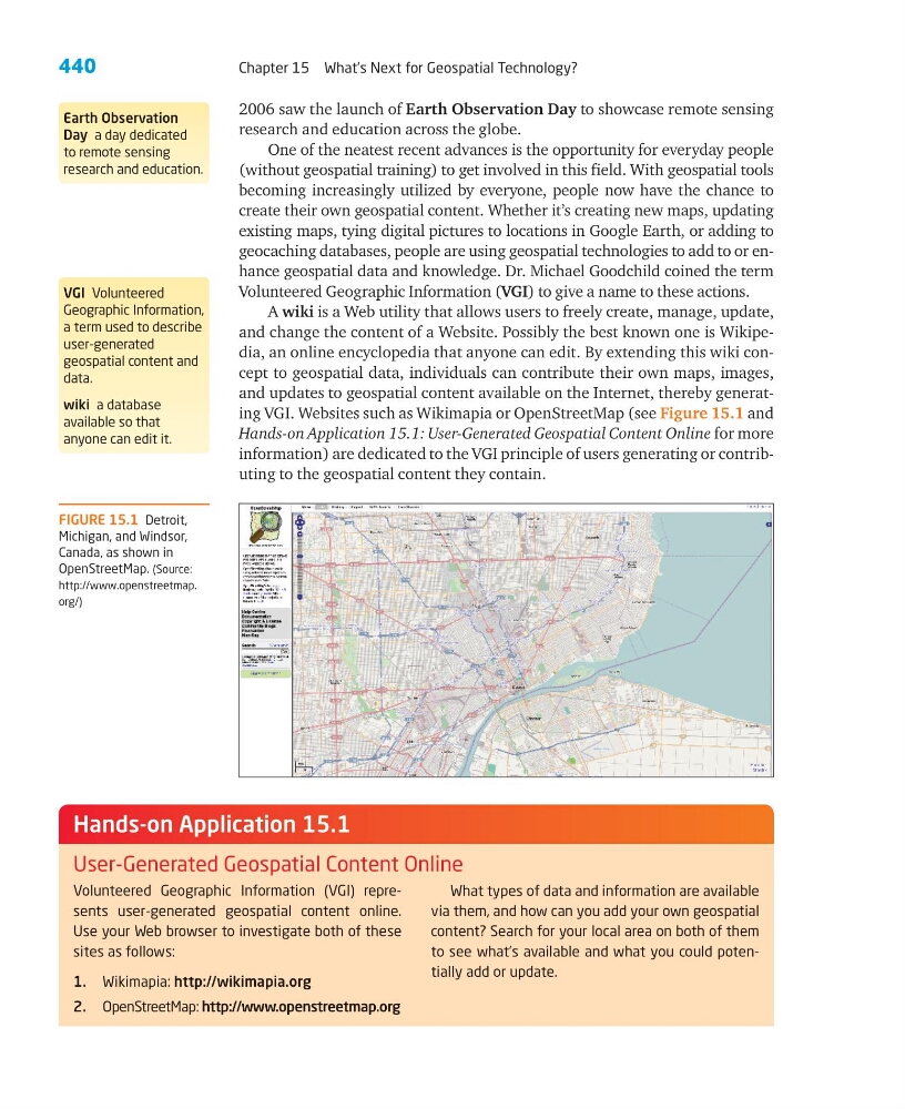
and updates to geospatial content available on the Internet, thereby generating VGI. Websites such as Wikimapia or OpenStreetMap (see Figure 15.1 and
Hands-on Application 15.1: User-Generated Geospatial Content Online for more
information) are dedicated to the VGI principle of users generating or contributing to the geospatial content they contain.
Earth Observation
Day a day dedicated
to remote sensing
research and education.
VGI Volunteered
Geographic Information,
a term used to describe
user-generated
geospatial content and
data.
wiki a database
available so that
anyone can edit it.
FIGURE 15.1 Detroit,
Michigan, and Windsor,
Canada, as shown in
OpenStreetMap. (Source:
http://www.openstreetmap.
org/)
Volunteered Geographic Information (VGI) represents user-generated geospatial content online.
Use your Web browser to investigate both of these
sites as follows:
1. Wikimapia: http://wikimapia.org
2. OpenStreetMap: http://www.openstreetmap.org
What types of data and information are available
via them, and how can you add your own geospatial
content? Search for your local area on both of them
to see what’s available and what you could potentially add or update.
Hands-on Application 15.1
User-Generated Geospatial Content Online
Chapter 15 What’s Next for Geospatial Technology?
2006 saw the launch of Earth Observation Day to showcase remote sensing
research and education across the globe.
One of the neatest recent advances is the opportunity for everyday people
(without geospatial training) to get involved in this field. With geospatial tools
becoming increasingly utilized by everyone, people now have the chance to
create their own geospatial content. Whether it’s creating new maps, updating
existing maps, tying digital pictures to locations in Google Earth, or adding to
geocaching databases, people are using geospatial technologies to add to or enhance geospatial data and knowledge. Dr. Michael Goodchild coined the term
Volunteered Geographic Information (VGI) to give a name to these actions.
A wiki is a Web utility that allows users to freely create, manage, update,
and change the content of a Website. Possibly the best known one is Wikipedia, an online encyclopedia that anyone can edit. By extending this wiki concept to geospatial data, individuals can contribute their own maps, images,
and updates to geospatial content available on the Internet, thereby generating VGI. Websites such as Wikimapia or OpenStreetMap (see Figure 15.1 and
Hands-on Application 15.1: User-Generated Geospatial Content Online for more
information) are dedicated to the VGI principle of users generating or contributing to the geospatial content they contain.
Earth Observation
Day a day dedicated
to remote sensing
research and education.
VGI Volunteered
Geographic Information,
a term used to describe
user-generated
geospatial content and
data.
wiki a database
available so that
anyone can edit it.
FIGURE 15.1 Detroit,
Michigan, and Windsor,
Canada, as shown in
OpenStreetMap. (Source:
http://www.openstreetmap.
org/)
Volunteered Geographic Information (VGI) represents user-generated geospatial content online.
Use your Web browser to investigate both of these
sites as follows:
1. Wikimapia: http://wikimapia.org
2. OpenStreetMap: http://www.openstreetmap.org
What types of data and information are available
via them, and how can you add your own geospatial
content? Search for your local area on both of them
to see what’s available and what you could potentially add or update.
Hands-on Application 15.1
User-Generated Geospatial Content Online