

383
What Is a DEM?
What Is a DEM?
A DEM is a Digital Elevation Model, a specific type of model of the terrain and
landscape. A DEM is a terrain model produced by the USGS and others. A DEM
is based on regularly spaced point data of elevations but can be converted to a
raster grid representation (see Chapter 5) for use with other geospatial data,
such as satellite imagery or GIS layers. When used in grid format, the elevation values are represented by the grid cell value, while the grid resolution
represents the size of the cell being measured. Thus, DEM resolution is measured in a manner similar to the way a remotely sensed image’s resolution
would be measured (see Chapter 10). If a DEM has 30-meter resolution, then
each of the DEM’s raster grid cells is set up at 30 meters in size. USGS DEMs
have been created using Digital Line Graph (DLG) information. Other methods of DEM creation involve the use of remotely sensed data or stereo imagery
(see Chapter 15) and photogrammetry to derive elevation values.
Another source of terrain data is the Shuttle Radar Topography Mission
(SRTM) a part of a mission of the Space Shuttle Endeavor in the year 2000.
For 11 days, Endeavor used a special radar system to map Earth’s terrain
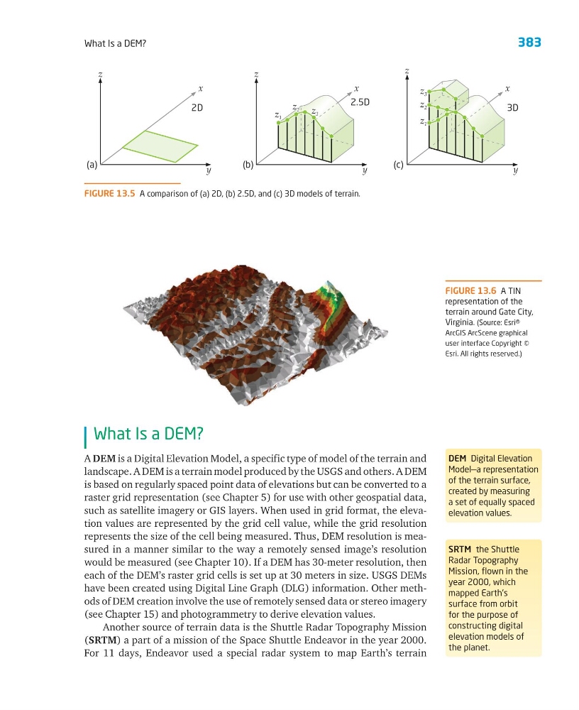
FIGURE 13.6 A TIN
representation of the
terrain around Gate City,
Virginia. (Source: Esri®
ArcGIS ArcScene graphical
user interface Copyright ©
Esri. All rights reserved.)
DEM Digital Elevation
Model—a representation
of the terrain surface,
created by measuring
a set of equally spaced
elevation values.
SRTM the Shuttle
Radar Topography
Mission, flown in the
year 2000, which
mapped Earth’s
surface from orbit
for the purpose of
constructing digital
elevation models of
the planet.
FIGURE 13.5 A comparison of (a) 2D, (b) 2.5D, and (c) 3D models of terrain.
z
y
(a)
2D
z
y
x
x
(b)
2.5D
3D
z
y
x
(c)
z 1
z 1
z 2
z 3
z 2
z 2 z 3
What Is a DEM?
What Is a DEM?
A DEM is a Digital Elevation Model, a specific type of model of the terrain and
landscape. A DEM is a terrain model produced by the USGS and others. A DEM
is based on regularly spaced point data of elevations but can be converted to a
raster grid representation (see Chapter 5) for use with other geospatial data,
such as satellite imagery or GIS layers. When used in grid format, the elevation values are represented by the grid cell value, while the grid resolution
represents the size of the cell being measured. Thus, DEM resolution is measured in a manner similar to the way a remotely sensed image’s resolution
would be measured (see Chapter 10). If a DEM has 30-meter resolution, then
each of the DEM’s raster grid cells is set up at 30 meters in size. USGS DEMs
have been created using Digital Line Graph (DLG) information. Other methods of DEM creation involve the use of remotely sensed data or stereo imagery
(see Chapter 15) and photogrammetry to derive elevation values.
Another source of terrain data is the Shuttle Radar Topography Mission
(SRTM) a part of a mission of the Space Shuttle Endeavor in the year 2000.
For 11 days, Endeavor used a special radar system to map Earth’s terrain
FIGURE 13.6 A TIN
representation of the
terrain around Gate City,
Virginia. (Source: Esri®
ArcGIS ArcScene graphical
user interface Copyright ©
Esri. All rights reserved.)
DEM Digital Elevation
Model—a representation
of the terrain surface,
created by measuring
a set of equally spaced
elevation values.
SRTM the Shuttle
Radar Topography
Mission, flown in the
year 2000, which
mapped Earth’s
surface from orbit
for the purpose of
constructing digital
elevation models of
the planet.
FIGURE 13.5 A comparison of (a) 2D, (b) 2.5D, and (c) 3D models of terrain.
z
y
(a)
2D
z
y
x
x
(b)
2.5D
3D
z
y
x
(c)
z 1
z 1
z 2
z 3
z 2
z 2 z 3