

365
How Can EOS Applications Be Easily Viewed and Analyzed?
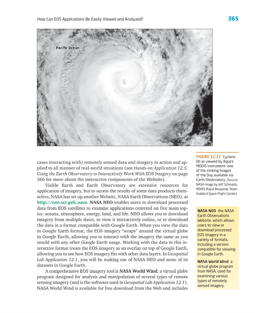
FIGURE 12.12 Cyclone
Oli as viewed by Aqua’s
MODIS instrument—one
of the striking Images
of the Day available via
Earth Observatory. (Source:
NASA Image by Jeff Schmaltz,
MODIS Rapid Response Team,
Goddard Space Flight Center)
cases interacting with) remotely sensed data and imagery in action and applied to all manner of real-world situations (see Hands-on Application 12.5:
Using the Earth Observatory to Interactively Work With EOS Imagery on page
366 for more about the interactive components of the Website).
Visible Earth and Earth Observatory are extensive resources for
application of imagery, but to access the results of some data products themselves, NASA has set up another Website, NASA Earth Observations (NEO), at
http://neo.sci.gsfc.nasa. NASA NEO enables users to download processed
data from EOS satellites to examine applications centered on five main topics: oceans, atmosphere, energy, land, and life. NEO allows you to download
imagery from multiple dates, to view it interactively online, or to download
the data in a format compatible with Google Earth. When you view the data
in Google Earth format, the EOS imagery “wraps” around the virtual globe
in Google Earth, allowing you to interact with the imagery the same as you
would with any other Google Earth usage. Working with the data in this interactive format treats the EOS imagery as an overlay on top of Google Earth,
allowing you to see how EOS imagery fits with other data layers. In Geospatial
Lab Application 12.1, you will be making use of NASA NEO and some of its
datasets in Google Earth.
A comprehensive EOS imagery tool is NASA World Wind, a virtual globe
program designed for analysis and manipulation of several types of remote
sensing imagery (and is the software used in Geospatial Lab Application 12.1).
NASA World Wind is available for free download from the Web and includes
100 km
Pacific Ocean
Pacific Ocean
Pacific Ocean
Tahiti
NASA NEO the NASA
Earth Observations
Website, which allows
users to view or
download processed
EOS imagery in a
variety of formats,
including a version
compatible for viewing
in Google Earth.
NASA World Wind a
virtual globe program
from NASA, used for
examining various
types of remotely
sensed imagery.
How Can EOS Applications Be Easily Viewed and Analyzed?
FIGURE 12.12 Cyclone
Oli as viewed by Aqua’s
MODIS instrument—one
of the striking Images
of the Day available via
Earth Observatory. (Source:
NASA Image by Jeff Schmaltz,
MODIS Rapid Response Team,
Goddard Space Flight Center)
cases interacting with) remotely sensed data and imagery in action and applied to all manner of real-world situations (see Hands-on Application 12.5:
Using the Earth Observatory to Interactively Work With EOS Imagery on page
366 for more about the interactive components of the Website).
Visible Earth and Earth Observatory are extensive resources for
application of imagery, but to access the results of some data products themselves, NASA has set up another Website, NASA Earth Observations (NEO), at
http://neo.sci.gsfc.nasa. NASA NEO enables users to download processed
data from EOS satellites to examine applications centered on five main topics: oceans, atmosphere, energy, land, and life. NEO allows you to download
imagery from multiple dates, to view it interactively online, or to download
the data in a format compatible with Google Earth. When you view the data
in Google Earth format, the EOS imagery “wraps” around the virtual globe
in Google Earth, allowing you to interact with the imagery the same as you
would with any other Google Earth usage. Working with the data in this interactive format treats the EOS imagery as an overlay on top of Google Earth,
allowing you to see how EOS imagery fits with other data layers. In Geospatial
Lab Application 12.1, you will be making use of NASA NEO and some of its
datasets in Google Earth.
A comprehensive EOS imagery tool is NASA World Wind, a virtual globe
program designed for analysis and manipulation of several types of remote
sensing imagery (and is the software used in Geospatial Lab Application 12.1).
NASA World Wind is available for free download from the Web and includes
100 km
Pacific Ocean
Pacific Ocean
Pacific Ocean
Tahiti
NASA NEO the NASA
Earth Observations
Website, which allows
users to view or
download processed
EOS imagery in a
variety of formats,
including a version
compatible for viewing
in Google Earth.
NASA World Wind a
virtual globe program
from NASA, used for
examining various
types of remotely
sensed imagery.