

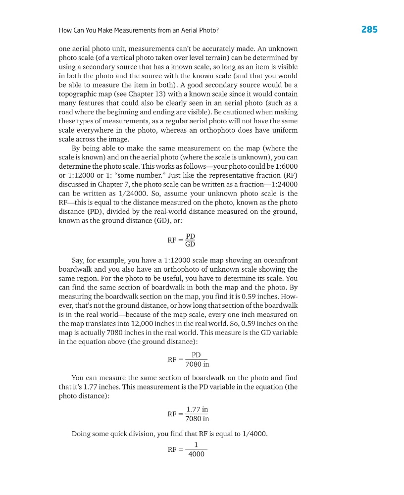
285
How Can You Make Measurements from an Aerial Photo?
RF ϭ
1
4000
one aerial photo unit, measurements can’t be accurately made. An unknown
photo scale (of a vertical photo taken over level terrain) can be determined by
using a secondary source that has a known scale, so long as an item is visible
in both the photo and the source with the known scale (and that you would
be able to measure the item in both). A good secondary source would be a
topographic map (see Chapter 13) with a known scale since it would contain
many features that could also be clearly seen in an aerial photo (such as a
road where the beginning and ending are visible). Be cautioned when making
these types of measurements, as a regular aerial photo will not have the same
scale everywhere in the photo, whereas an orthophoto does have uniform
scale across the image.
By being able to make the same measurement on the map (where the
scale is known) and on the aerial photo (where the scale is unknown), you can
determine the photo scale. This works as follows—your photo could be 1:6000
or 1:12000 or 1: ‘‘some number.” Just like the representative fraction (RF)
discussed in Chapter 7, the photo scale can be written as a fraction—1:24000
can be written as 1/24000. So, assume your unknown photo scale is the
RF—this is equal to the distance measured on the photo, known as the photo
distance (PD), divided by the real-world distance measured on the ground,
known as the ground distance (GD), or:
RF ϭ
PD
GD
RF ϭ
1.77 in
7080 in
Say, for example, you have a 1:12000 scale map showing an oceanfront
boardwalk and you also have an orthophoto of unknown scale showing the
same region. For the photo to be useful, you have to determine its scale. You
can find the same section of boardwalk in both the map and the photo. By
measuring the boardwalk section on the map, you find it is 0.59 inches. However, that’s not the ground distance, or how long that section of the boardwalk
is in the real world—because of the map scale, every one inch measured on
the map translates into 12,000 inches in the real world. So, 0.59 inches on the
map is actually 7080 inches in the real world. This measure is the GD variable
in the equation above (the ground distance):
You can measure the same section of boardwalk on the photo and find
that it’s 1.77 inches. This measurement is the PD variable in the equation (the
photo distance):
RF ϭ
PD
7080 in
Doing some quick division, you find that RF is equal to 1/4000.
How Can You Make Measurements from an Aerial Photo?
RF ϭ
1
4000
one aerial photo unit, measurements can’t be accurately made. An unknown
photo scale (of a vertical photo taken over level terrain) can be determined by
using a secondary source that has a known scale, so long as an item is visible
in both the photo and the source with the known scale (and that you would
be able to measure the item in both). A good secondary source would be a
topographic map (see Chapter 13) with a known scale since it would contain
many features that could also be clearly seen in an aerial photo (such as a
road where the beginning and ending are visible). Be cautioned when making
these types of measurements, as a regular aerial photo will not have the same
scale everywhere in the photo, whereas an orthophoto does have uniform
scale across the image.
By being able to make the same measurement on the map (where the
scale is known) and on the aerial photo (where the scale is unknown), you can
determine the photo scale. This works as follows—your photo could be 1:6000
or 1:12000 or 1: ‘‘some number.” Just like the representative fraction (RF)
discussed in Chapter 7, the photo scale can be written as a fraction—1:24000
can be written as 1/24000. So, assume your unknown photo scale is the
RF—this is equal to the distance measured on the photo, known as the photo
distance (PD), divided by the real-world distance measured on the ground,
known as the ground distance (GD), or:
RF ϭ
PD
GD
RF ϭ
1.77 in
7080 in
Say, for example, you have a 1:12000 scale map showing an oceanfront
boardwalk and you also have an orthophoto of unknown scale showing the
same region. For the photo to be useful, you have to determine its scale. You
can find the same section of boardwalk in both the map and the photo. By
measuring the boardwalk section on the map, you find it is 0.59 inches. However, that’s not the ground distance, or how long that section of the boardwalk
is in the real world—because of the map scale, every one inch measured on
the map translates into 12,000 inches in the real world. So, 0.59 inches on the
map is actually 7080 inches in the real world. This measure is the GD variable
in the equation above (the ground distance):
You can measure the same section of boardwalk on the photo and find
that it’s 1.77 inches. This measurement is the PD variable in the equation (the
photo distance):
RF ϭ
PD
7080 in
Doing some quick division, you find that RF is equal to 1/4000.