

272
Chapter 9 Remotely Sensed Images from Above
supplies to be found. Countless aerial photos were shot and developed over
the course of the war, and aerial photography greatly contributed to military
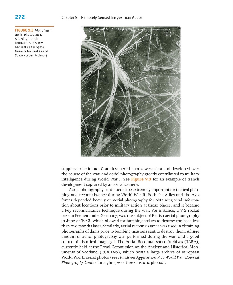
intelligence during World War I. See Figure 9.3 for an example of trench
development captured by an aerial camera.
Aerial photography continued to be extremely important for tactical planning and reconnaissance during World War II. Both the Allies and the Axis
forces depended heavily on aerial photography for obtaining vital information about locations prior to military action at those places, and it became
a key reconnaissance technique during the war. For instance, a V-2 rocket
base in Peenemunde, Germany, was the subject of British aerial photography
in June of 1943, which allowed for bombing strikes to destroy the base less
than two months later. Similarly, aerial reconnaissance was used in obtaining
photographs of dams prior to bombing missions sent to destroy them. A huge
amount of aerial photography was performed during the war, and a good
source of historical imagery is The Aerial Reconnaissance Archives (TARA),
currently held at the Royal Commission on the Ancient and Historical Monuments of Scotland (RCAHMS), which hosts a large archive of European
World War II aerial photos (see Hands-on Application 9.1: World War II Aerial
Photography Online for a glimpse of these historic photos).
FIGURE 9.3 World War I
aerial photography
showing trench
formations. (Source:
National Air and Space
Museum, National Air and
Space Museum Archives)
Chapter 9 Remotely Sensed Images from Above
supplies to be found. Countless aerial photos were shot and developed over
the course of the war, and aerial photography greatly contributed to military
intelligence during World War I. See Figure 9.3 for an example of trench
development captured by an aerial camera.
Aerial photography continued to be extremely important for tactical planning and reconnaissance during World War II. Both the Allies and the Axis
forces depended heavily on aerial photography for obtaining vital information about locations prior to military action at those places, and it became
a key reconnaissance technique during the war. For instance, a V-2 rocket
base in Peenemunde, Germany, was the subject of British aerial photography
in June of 1943, which allowed for bombing strikes to destroy the base less
than two months later. Similarly, aerial reconnaissance was used in obtaining
photographs of dams prior to bombing missions sent to destroy them. A huge
amount of aerial photography was performed during the war, and a good
source of historical imagery is The Aerial Reconnaissance Archives (TARA),
currently held at the Royal Commission on the Ancient and Historical Monuments of Scotland (RCAHMS), which hosts a large archive of European
World War II aerial photos (see Hands-on Application 9.1: World War II Aerial
Photography Online for a glimpse of these historic photos).
FIGURE 9.3 World War I
aerial photography
showing trench
formations. (Source:
National Air and Space
Museum, National Air and
Space Museum Archives)