

9
What Is Geospatial Data?
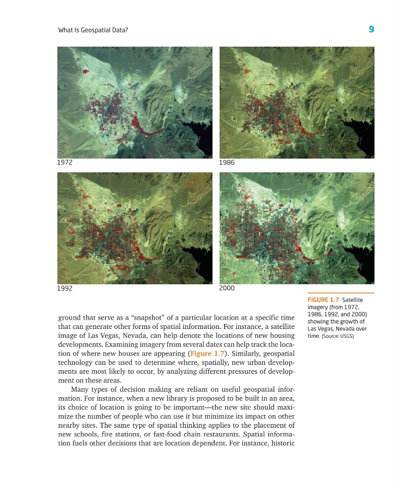
ground that serve as a “snapshot” of a particular location at a specific time
that can generate other forms of spatial information. For instance, a satellite
image of Las Vegas, Nevada, can help denote the locations of new housing
developments. Examining imagery from several dates can help track the location of where new houses are appearing (Figure 1.7). Similarly, geospatial
technology can be used to determine where, spatially, new urban developments are most likely to occur, by analyzing different pressures of development on these areas.
Many types of decision making are reliant on useful geospatial information. For instance, when a new library is proposed to be built in an area,
its choice of location is going to be important—the new site should maximize the number of people who can use it but minimize its impact on other
nearby sites. The same type of spatial thinking applies to the placement of
new schools, fire stations, or fast-food chain restaurants. Spatial information fuels other decisions that are location dependent. For instance, historic
FIGURE 1.7 Satellite
imagery (from 1972,
1986, 1992, and 2000)
showing the growth of
Las Vegas, Nevada over
time. (Source: USGS)
1972
1986
1992
2000
What Is Geospatial Data?
ground that serve as a “snapshot” of a particular location at a specific time
that can generate other forms of spatial information. For instance, a satellite
image of Las Vegas, Nevada, can help denote the locations of new housing
developments. Examining imagery from several dates can help track the location of where new houses are appearing (Figure 1.7). Similarly, geospatial
technology can be used to determine where, spatially, new urban developments are most likely to occur, by analyzing different pressures of development on these areas.
Many types of decision making are reliant on useful geospatial information. For instance, when a new library is proposed to be built in an area,
its choice of location is going to be important—the new site should maximize the number of people who can use it but minimize its impact on other
nearby sites. The same type of spatial thinking applies to the placement of
new schools, fire stations, or fast-food chain restaurants. Spatial information fuels other decisions that are location dependent. For instance, historic
FIGURE 1.7 Satellite
imagery (from 1972,
1986, 1992, and 2000)
showing the growth of
Las Vegas, Nevada over
time. (Source: USGS)
1972
1986
1992
2000