

257
Geocoding and Shortest Path Analysis: ArcGIS Version
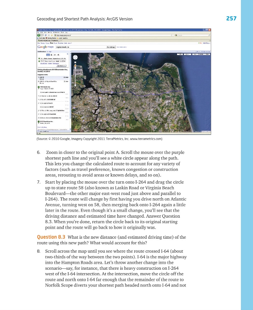
6. Zoom in closer to the original point A. Scroll the mouse over the purple
shortest path line and you’ll see a white circle appear along the path.
This lets you change the calculated route to account for any variety of
factors (such as travel preference, known congestion or construction
areas, rerouting to avoid areas or known delays, and so on).
7. Start by placing the mouse over the turn onto I-264 and drag the circle
up to state route 58 (also known as Laskin Road or Virginia Beach
Boulevard—the other major east-west road just above and parallel to
I-264). The route will change by first having you drive north on Atlantic
Avenue, turning west on 58, then merging back onto I-264 again a little
later in the route. Even though it’s a small change, you’ll see that the
driving distance and estimated time have changed. Answer Question
8.3. When you’re done, return the circle back to its original starting
point and the route will go back to how it originally was.
Question 8.3 What is the new distance (and estimated driving time) of the
route using this new path? What would account for this?
8. Scroll across the map until you see where the route crossed I-64 (about
two-thirds of the way between the two points). I-64 is the major highway
into the Hampton Roads area. Let’s throw another change into the
scenario—say, for instance, that there is heavy construction on I-264
west of the I-64 intersection. At the intersection, move the circle off the
route and north onto I-64 far enough that the remainder of the route to
Norfolk Scope diverts your shortest path headed north onto I-64 and not
(Source: © 2010 Google, Imagery Copyright 2011 TerraMetrics, Inc. www.terrametrics.com)
Geocoding and Shortest Path Analysis: ArcGIS Version
6. Zoom in closer to the original point A. Scroll the mouse over the purple
shortest path line and you’ll see a white circle appear along the path.
This lets you change the calculated route to account for any variety of
factors (such as travel preference, known congestion or construction
areas, rerouting to avoid areas or known delays, and so on).
7. Start by placing the mouse over the turn onto I-264 and drag the circle
up to state route 58 (also known as Laskin Road or Virginia Beach
Boulevard—the other major east-west road just above and parallel to
I-264). The route will change by first having you drive north on Atlantic
Avenue, turning west on 58, then merging back onto I-264 again a little
later in the route. Even though it’s a small change, you’ll see that the
driving distance and estimated time have changed. Answer Question
8.3. When you’re done, return the circle back to its original starting
point and the route will go back to how it originally was.
Question 8.3 What is the new distance (and estimated driving time) of the
route using this new path? What would account for this?
8. Scroll across the map until you see where the route crossed I-64 (about
two-thirds of the way between the two points). I-64 is the major highway
into the Hampton Roads area. Let’s throw another change into the
scenario—say, for instance, that there is heavy construction on I-264
west of the I-64 intersection. At the intersection, move the circle off the
route and north onto I-64 far enough that the remainder of the route to
Norfolk Scope diverts your shortest path headed north onto I-64 and not
(Source: © 2010 Google, Imagery Copyright 2011 TerraMetrics, Inc. www.terrametrics.com)