

6
Chapter 1 It’s a Geospatial World Out There
evacuation plans to smoke-plume modeling can be examined using geospatial technology. Disaster mitigation and recovery efforts can be greatly
enhanced through the use of current satellite imagery and location-based
capabilities.
Law Enforcement
The locations of various types of crimes can be plotted using GIS. Law enforcement officials can use this information for analysis of patterns (Figure 1.5)
as well as determining potential new crime areas. Geospatial technology
can be used in several other ways beyond mapping and analysis; for instance, high-resolution aerial photography of locations where police patrol
can be gathered to provide further information about potentially dangerous areas.
Health and Human Services
Geospatial technology is used for a variety of health-related services. For
example, monitoring of diseases, tracking sources of diseases, and mapping
health-related issues (such as the spread of H1N1 or other influenza; see
Figure 1.6) are all tasks that can be completed using geospatial technology
applications.
Real Estate
Through geospatial technology, realtors and appraisers (as well as home buyers and sellers) can create and examine maps of homes and quickly compare
housing prices and values of nearby or similar properties. Other features of a
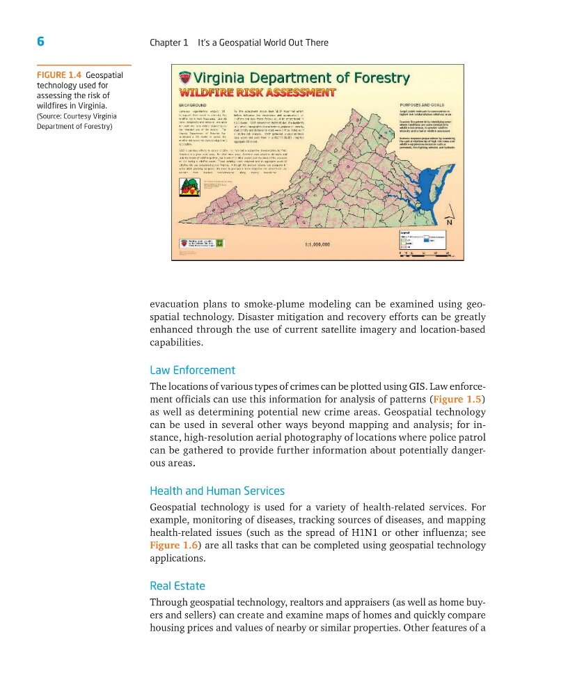
FIGURE 1.4 Geospatial
technology used for
assessing the risk of
wildfires in Virginia.
(Source: Courtesy Virginia
Department of Forestry)
Chapter 1 It’s a Geospatial World Out There
evacuation plans to smoke-plume modeling can be examined using geospatial technology. Disaster mitigation and recovery efforts can be greatly
enhanced through the use of current satellite imagery and location-based
capabilities.
Law Enforcement
The locations of various types of crimes can be plotted using GIS. Law enforcement officials can use this information for analysis of patterns (Figure 1.5)
as well as determining potential new crime areas. Geospatial technology
can be used in several other ways beyond mapping and analysis; for instance, high-resolution aerial photography of locations where police patrol
can be gathered to provide further information about potentially dangerous areas.
Health and Human Services
Geospatial technology is used for a variety of health-related services. For
example, monitoring of diseases, tracking sources of diseases, and mapping
health-related issues (such as the spread of H1N1 or other influenza; see
Figure 1.6) are all tasks that can be completed using geospatial technology
applications.
Real Estate
Through geospatial technology, realtors and appraisers (as well as home buyers and sellers) can create and examine maps of homes and quickly compare
housing prices and values of nearby or similar properties. Other features of a
FIGURE 1.4 Geospatial
technology used for
assessing the risk of
wildfires in Virginia.
(Source: Courtesy Virginia
Department of Forestry)