

228
Chapter 8 Getting There Quicker with Geospatial Technology
a FRADDL: This is the start of the address range on the left side of the street
(for instance, if the street addresses go from 101 to 199, this value would
be 101).
a TOADDL: This is the end of the address range on the left side of the street
(for instance, if the street addresses go from 101 to 199, this value would
be 199).
a FRADDR: This is the start of the address range on the right side of the
street (for instance, if the street addresses go from 100 to 198, this value
would be 100).
a TOADDR: This is the end of the address range on the left side of the street
(for instance, if the street addresses go from 100 to 198, this value would
be 198).
a ZIPL: This is the zip code used for addresses on the left side of the
street.
a ZIPR: This is the zip code used for addresses on the right side of the
street.
These attributes define the characteristics of each road segment, and
similar attributes would be found in road-network data, such as other street
centerline files. If these attributes are incorrect, then the base network map
will be incorrect. If the vehicle navigation system gives you incorrect street
names or calls a road “east” when it’s really “west,” it’s likely that there are
incorrect values in the base network data’s attributes.
The TIGER file attributes (or similar base road-network data created by
others) concerning specific address ranges, zip-code information, and detailed data for the names of roads can be used as a base map source for other
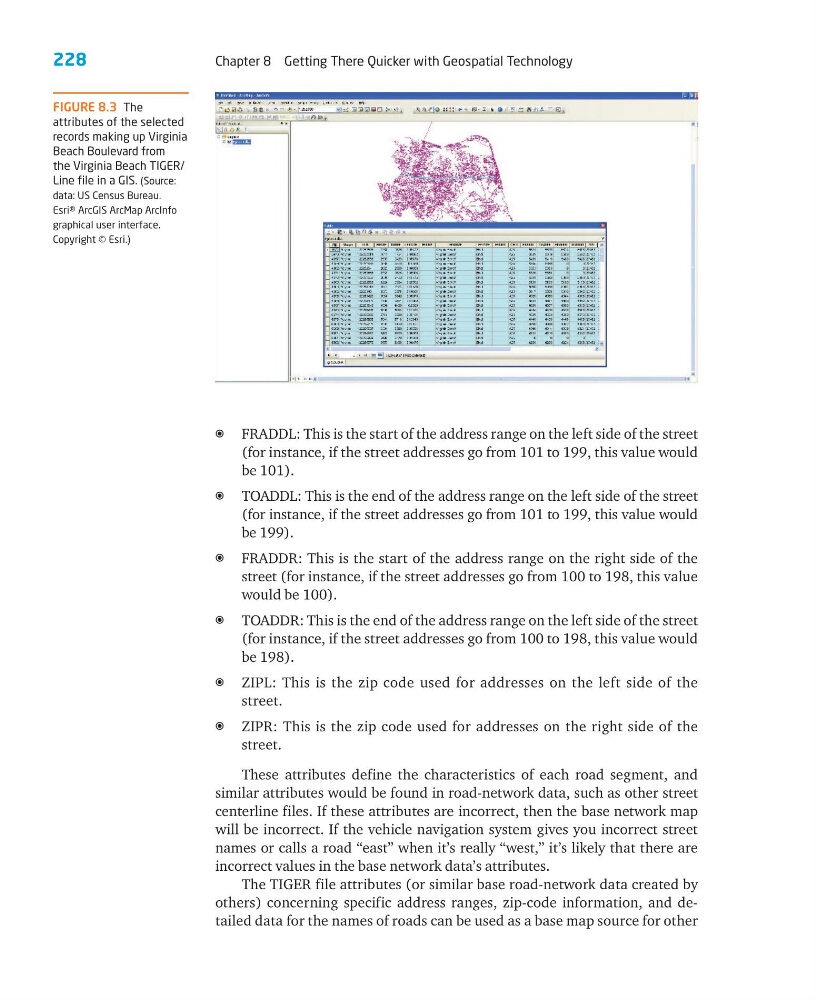
FIGURE 8.3 The
attributes of the selected
records making up Virginia
Beach Boulevard from
the Virginia Beach TIGER/
Line file in a GIS. (Source:
data: US Census Bureau.
Esri® ArcGIS ArcMap ArcInfo
graphical user interface.
Copyright © Esri.)
Chapter 8 Getting There Quicker with Geospatial Technology
a FRADDL: This is the start of the address range on the left side of the street
(for instance, if the street addresses go from 101 to 199, this value would
be 101).
a TOADDL: This is the end of the address range on the left side of the street
(for instance, if the street addresses go from 101 to 199, this value would
be 199).
a FRADDR: This is the start of the address range on the right side of the
street (for instance, if the street addresses go from 100 to 198, this value
would be 100).
a TOADDR: This is the end of the address range on the left side of the street
(for instance, if the street addresses go from 100 to 198, this value would
be 198).
a ZIPL: This is the zip code used for addresses on the left side of the
street.
a ZIPR: This is the zip code used for addresses on the right side of the
street.
These attributes define the characteristics of each road segment, and
similar attributes would be found in road-network data, such as other street
centerline files. If these attributes are incorrect, then the base network map
will be incorrect. If the vehicle navigation system gives you incorrect street
names or calls a road “east” when it’s really “west,” it’s likely that there are
incorrect values in the base network data’s attributes.
The TIGER file attributes (or similar base road-network data created by
others) concerning specific address ranges, zip-code information, and detailed data for the names of roads can be used as a base map source for other
FIGURE 8.3 The
attributes of the selected
records making up Virginia
Beach Boulevard from
the Virginia Beach TIGER/
Line file in a GIS. (Source:
data: US Census Bureau.
Esri® ArcGIS ArcMap ArcInfo
graphical user interface.
Copyright © Esri.)