

226
Chapter 8 Getting There Quicker with Geospatial Technology
or GIS instructs you to make a right-hand turn onto the freeway that you’re
currently driving under, then something’s gone wrong with some aspect of
the technology).
When a network is being modeled, each edge is considered to be a separate entity, not necessarily each individual street. A long city road may be
modeled in the GIS as several line segments, with each segment representing a section of the road. A major urban street may be made up of more than
100 line segments—each segment being a different section of the road (with
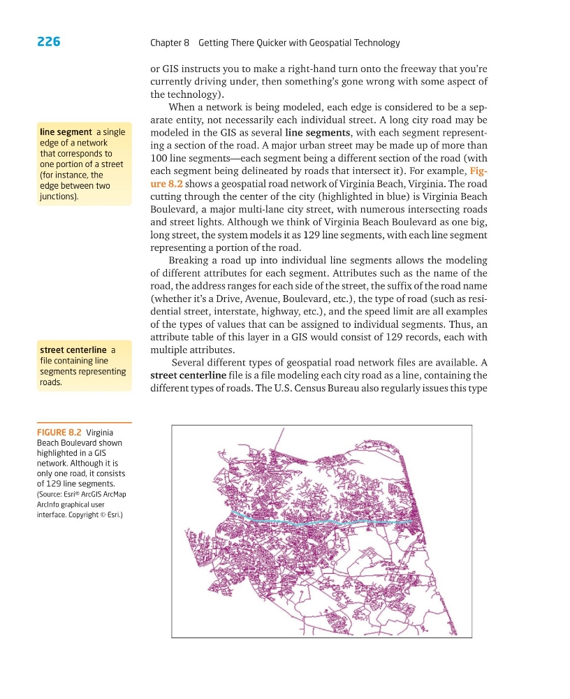
each segment being delineated by roads that intersect it). For example, Figure 8.2 shows a geospatial road network of Virginia Beach, Virginia. The road
cutting through the center of the city (highlighted in blue) is Virginia Beach
Boulevard, a major multi-lane city street, with numerous intersecting roads
and street lights. Although we think of Virginia Beach Boulevard as one big,
long street, the system models it as 129 line segments, with each line segment
representing a portion of the road.
Breaking a road up into individual line segments allows the modeling
of different attributes for each segment. Attributes such as the name of the
road, the address ranges for each side of the street, the suffix of the road name
(whether it’s a Drive, Avenue, Boulevard, etc.), the type of road (such as residential street, interstate, highway, etc.), and the speed limit are all examples
of the types of values that can be assigned to individual segments. Thus, an
attribute table of this layer in a GIS would consist of 129 records, each with
multiple attributes.
Several different types of geospatial road network files are available. A
street centerline file is a file modeling each city road as a line, containing the
different types of roads. The U.S. Census Bureau also regularly issues this type
line segment a single
edge of a network
that corresponds to
one portion of a street
(for instance, the
edge between two
junctions).
street centerline a
file containing line
segments representing
roads.
FIGURE 8.2 Virginia
Beach Boulevard shown
highlighted in a GIS
network. Although it is
only one road, it consists
of 129 line segments.
(Source: Esri® ArcGIS ArcMap
ArcInfo graphical user
interface. Copyright © Esri.)
Chapter 8 Getting There Quicker with Geospatial Technology
or GIS instructs you to make a right-hand turn onto the freeway that you’re
currently driving under, then something’s gone wrong with some aspect of
the technology).
When a network is being modeled, each edge is considered to be a separate entity, not necessarily each individual street. A long city road may be
modeled in the GIS as several line segments, with each segment representing a section of the road. A major urban street may be made up of more than
100 line segments—each segment being a different section of the road (with
each segment being delineated by roads that intersect it). For example, Figure 8.2 shows a geospatial road network of Virginia Beach, Virginia. The road
cutting through the center of the city (highlighted in blue) is Virginia Beach
Boulevard, a major multi-lane city street, with numerous intersecting roads
and street lights. Although we think of Virginia Beach Boulevard as one big,
long street, the system models it as 129 line segments, with each line segment
representing a portion of the road.
Breaking a road up into individual line segments allows the modeling
of different attributes for each segment. Attributes such as the name of the
road, the address ranges for each side of the street, the suffix of the road name
(whether it’s a Drive, Avenue, Boulevard, etc.), the type of road (such as residential street, interstate, highway, etc.), and the speed limit are all examples
of the types of values that can be assigned to individual segments. Thus, an
attribute table of this layer in a GIS would consist of 129 records, each with
multiple attributes.
Several different types of geospatial road network files are available. A
street centerline file is a file modeling each city road as a line, containing the
different types of roads. The U.S. Census Bureau also regularly issues this type
line segment a single
edge of a network
that corresponds to
one portion of a street
(for instance, the
edge between two
junctions).
street centerline a
file containing line
segments representing
roads.
FIGURE 8.2 Virginia
Beach Boulevard shown
highlighted in a GIS
network. Although it is
only one road, it consists
of 129 line segments.
(Source: Esri® ArcGIS ArcMap
ArcInfo graphical user
interface. Copyright © Esri.)