

100
Chapter 5 Working With Digital Spatial Data and GIS
using data that has something to do with a location, there’s nothing in the
spreadsheet that allows you to examine that data in a spatial context (such as
translating the housing values into a map of where these houses are).
The ability to map the real-world locations of the houses, spatially examine trends in housing values, and search for patterns or clusters in the spatial
data is what makes GIS unique. Using the coordinate and measurement concepts discussed in the previous chapters allows us to create, map, and analyze
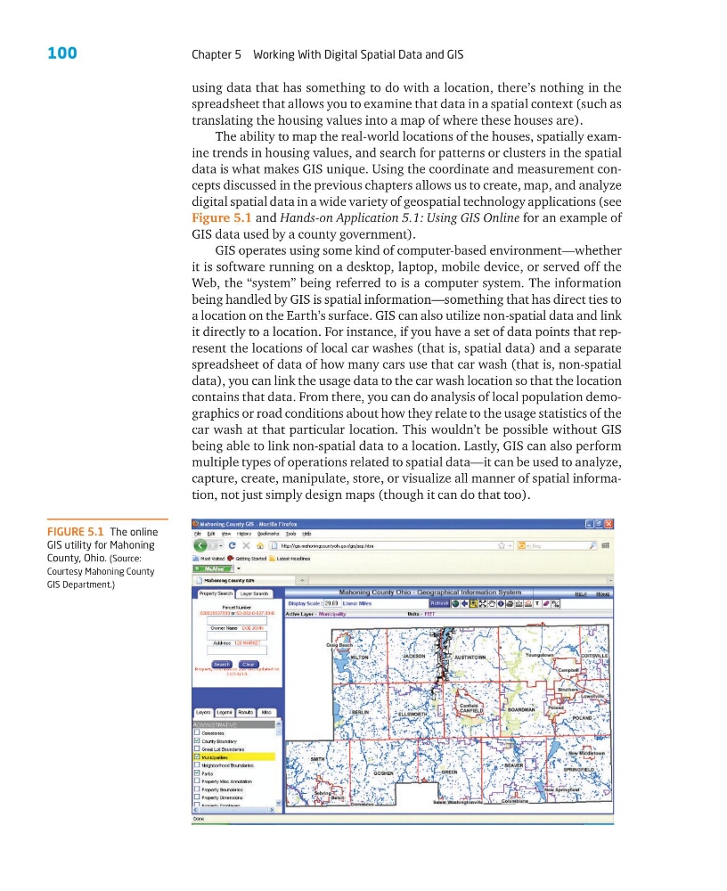
digital spatial data in a wide variety of geospatial technology applications (see
Figure 5.1 and Hands-on Application 5.1: Using GIS Online for an example of
GIS data used by a county government).
GIS operates using some kind of computer-based environment—whether
it is software running on a desktop, laptop, mobile device, or served off the
Web, the “system” being referred to is a computer system. The information
being handled by GIS is spatial information—something that has direct ties to
a location on the Earth’s surface. GIS can also utilize non-spatial data and link
it directly to a location. For instance, if you have a set of data points that represent the locations of local car washes (that is, spatial data) and a separate
spreadsheet of data of how many cars use that car wash (that is, non-spatial
data), you can link the usage data to the car wash location so that the location
contains that data. From there, you can do analysis of local population demographics or road conditions about how they relate to the usage statistics of the
car wash at that particular location. This wouldn’t be possible without GIS
being able to link non-spatial data to a location. Lastly, GIS can also perform
multiple types of operations related to spatial data—it can be used to analyze,
capture, create, manipulate, store, or visualize all manner of spatial information, not just simply design maps (though it can do that too).
FIGURE 5.1 The online
GIS utility for Mahoning
County, Ohio. (Source:
Courtesy Mahoning County
GIS Department.)
Chapter 5 Working With Digital Spatial Data and GIS
using data that has something to do with a location, there’s nothing in the
spreadsheet that allows you to examine that data in a spatial context (such as
translating the housing values into a map of where these houses are).
The ability to map the real-world locations of the houses, spatially examine trends in housing values, and search for patterns or clusters in the spatial
data is what makes GIS unique. Using the coordinate and measurement concepts discussed in the previous chapters allows us to create, map, and analyze
digital spatial data in a wide variety of geospatial technology applications (see
Figure 5.1 and Hands-on Application 5.1: Using GIS Online for an example of
GIS data used by a county government).
GIS operates using some kind of computer-based environment—whether
it is software running on a desktop, laptop, mobile device, or served off the
Web, the “system” being referred to is a computer system. The information
being handled by GIS is spatial information—something that has direct ties to
a location on the Earth’s surface. GIS can also utilize non-spatial data and link
it directly to a location. For instance, if you have a set of data points that represent the locations of local car washes (that is, spatial data) and a separate
spreadsheet of data of how many cars use that car wash (that is, non-spatial
data), you can link the usage data to the car wash location so that the location
contains that data. From there, you can do analysis of local population demographics or road conditions about how they relate to the usage statistics of the
car wash at that particular location. This wouldn’t be possible without GIS
being able to link non-spatial data to a location. Lastly, GIS can also perform
multiple types of operations related to spatial data—it can be used to analyze,
capture, create, manipulate, store, or visualize all manner of spatial information, not just simply design maps (though it can do that too).
FIGURE 5.1 The online
GIS utility for Mahoning
County, Ohio. (Source:
Courtesy Mahoning County
GIS Department.)