

Session 3 : Hydrological analysis of two sub-catchments of the Mareb River (Eritrea)
252
INTRODUCTION
In order to allow an expansion of irrigation in the highlands, a programme of small dams
construction has been undertaken in the past ten years. At the time of dams construction,
estimates of catchment yield was not possible and the optimum reservoir capacity could not be
determined (FAO, 1994), because of information about water resources, which is a main
constraint for planning agricultural development in Eritrea. This has resulted, in some cases, in
rapid sedimentation of the reservoir where the catchment was too large for the dam, or in the
reservoir not filling during the rainy season if the catchment was too small.
Surface runoff depends on a great number of factors, such as rainfall characteristics,
watershed morphometric characteristics, soil physical characteristics (depth, texture, structure,
hydraulic conductivity), land cover, land use, and soil moisture conditions prior to rainfall events.
There are many well known methods for predicting surface runoff either from empirical formulas
or from deterministic models (Hudson, 1971).
In this work the Curve Number method of the US-SCS has been utilized in two different
watersheds in Eritrea, testing the potential contribution of satellite data (SPOT XS Nov. 1993
and Landsat TM Nov. 1987) and aerial photos (1:50 000, Nov. 1964) to runoff estimation.
The study area is part of a larger area which had been previously surveyed and mapped with
an integrated approach, describing in detail climate, geology, geomorphology, soils and land
cover (Ongaro and Sarfatti, 1995). Remotely sensed data have been used to estimate biomass
(Viti et al.; 1995) and to calculate soil erosion (Colombo et al., 1995).
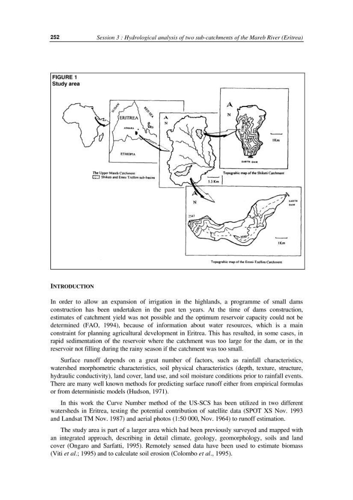
FIGURE 1
Study area
252
INTRODUCTION
In order to allow an expansion of irrigation in the highlands, a programme of small dams
construction has been undertaken in the past ten years. At the time of dams construction,
estimates of catchment yield was not possible and the optimum reservoir capacity could not be
determined (FAO, 1994), because of information about water resources, which is a main
constraint for planning agricultural development in Eritrea. This has resulted, in some cases, in
rapid sedimentation of the reservoir where the catchment was too large for the dam, or in the
reservoir not filling during the rainy season if the catchment was too small.
Surface runoff depends on a great number of factors, such as rainfall characteristics,
watershed morphometric characteristics, soil physical characteristics (depth, texture, structure,
hydraulic conductivity), land cover, land use, and soil moisture conditions prior to rainfall events.
There are many well known methods for predicting surface runoff either from empirical formulas
or from deterministic models (Hudson, 1971).
In this work the Curve Number method of the US-SCS has been utilized in two different
watersheds in Eritrea, testing the potential contribution of satellite data (SPOT XS Nov. 1993
and Landsat TM Nov. 1987) and aerial photos (1:50 000, Nov. 1964) to runoff estimation.
The study area is part of a larger area which had been previously surveyed and mapped with
an integrated approach, describing in detail climate, geology, geomorphology, soils and land
cover (Ongaro and Sarfatti, 1995). Remotely sensed data have been used to estimate biomass
(Viti et al.; 1995) and to calculate soil erosion (Colombo et al., 1995).
FIGURE 1
Study area