

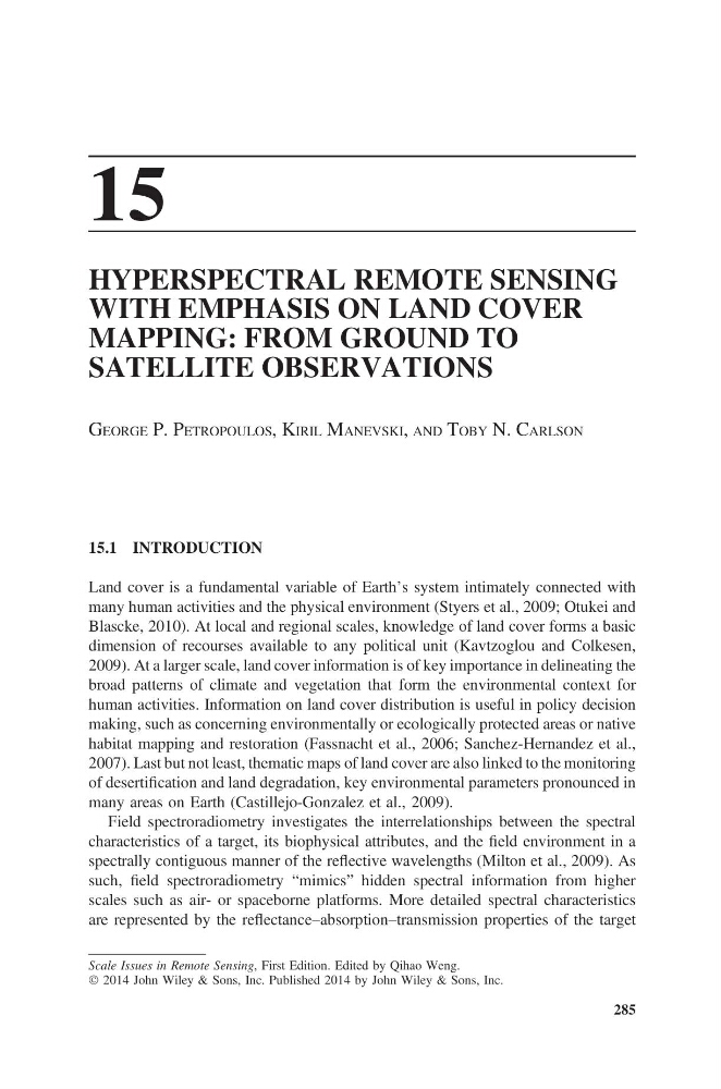
15
HYPERSPECTRAL REMOTE SENSING
WITH EMPHASIS ON LAND COVER
MAPPING: FROM GROUND TO
SATELLITE OBSERVATIONS
GEORGE P. PETROPOULOS, KIRIL MANEVSKI, AND TOBY N. CARLSON
15.1 INTRODUCTION
Land cover is a fundamental variable of Earth’s system intimately connected with
many human activities and the physical environment (Styers et al., 2009; Otukei and
Blascke, 2010). At local and regional scales, knowledge of land cover forms a basic
dimension of recourses available to any political unit (Kavtzoglou and Colkesen,
2009). At a larger scale, land cover information is of key importance in delineating the
broad patterns of climate and vegetation that form the environmental context for
human activities. Information on land cover distribution is useful in policy decision
making, such as concerning environmentally or ecologically protected areas or native
habitat mapping and restoration (Fassnacht et al., 2006; Sanchez-Hernandez et al.,
2007). Last but not least, thematic maps of land cover are also linked to the monitoring
of desertification and land degradation, key environmental parameters pronounced in
many areas on Earth (Castillejo-Gonzalez et al., 2009).
Field spectroradiometry investigates the interrelationships between the spectral
characteristics of a target, its biophysical attributes, and the field environment in a
spectrally contiguous manner of the reflective wavelengths (Milton et al., 2009). As
such, field spectroradiometry “mimics” hidden spectral information from higher
scales such as air- or spaceborne platforms. More detailed spectral characteristics
are represented by the reflectance–absorption–transmission properties of the target
285
Scale Issues in Remote Sensing, First Edition. Edited by Qihao Weng.
Ó 2014 John Wiley & Sons, Inc. Published 2014 by John Wiley & Sons, Inc.
HYPERSPECTRAL REMOTE SENSING
WITH EMPHASIS ON LAND COVER
MAPPING: FROM GROUND TO
SATELLITE OBSERVATIONS
GEORGE P. PETROPOULOS, KIRIL MANEVSKI, AND TOBY N. CARLSON
15.1 INTRODUCTION
Land cover is a fundamental variable of Earth’s system intimately connected with
many human activities and the physical environment (Styers et al., 2009; Otukei and
Blascke, 2010). At local and regional scales, knowledge of land cover forms a basic
dimension of recourses available to any political unit (Kavtzoglou and Colkesen,
2009). At a larger scale, land cover information is of key importance in delineating the
broad patterns of climate and vegetation that form the environmental context for
human activities. Information on land cover distribution is useful in policy decision
making, such as concerning environmentally or ecologically protected areas or native
habitat mapping and restoration (Fassnacht et al., 2006; Sanchez-Hernandez et al.,
2007). Last but not least, thematic maps of land cover are also linked to the monitoring
of desertification and land degradation, key environmental parameters pronounced in
many areas on Earth (Castillejo-Gonzalez et al., 2009).
Field spectroradiometry investigates the interrelationships between the spectral
characteristics of a target, its biophysical attributes, and the field environment in a
spectrally contiguous manner of the reflective wavelengths (Milton et al., 2009). As
such, field spectroradiometry “mimics” hidden spectral information from higher
scales such as air- or spaceborne platforms. More detailed spectral characteristics
are represented by the reflectance–absorption–transmission properties of the target
285
Scale Issues in Remote Sensing, First Edition. Edited by Qihao Weng.
Ó 2014 John Wiley & Sons, Inc. Published 2014 by John Wiley & Sons, Inc.