

9.4.1 Very High Spatial Resolution Airborne Imagery
The developed methodology was applied to a variety of very high and ultrahigh
resolution remote sensing imagery. At first a 5-cm-resolution image from a DMC
airborne digital scanner was tested. These data are practically impossible to handle
using traditional pixel-based classification and image analysis approaches. As shown
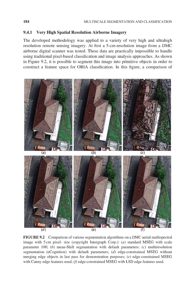
in Figure 9.2, it is possible to segment this image into primitive objects in order to
construct a feature space for OBIA classification. In this figure, a comparison of
FIGURE 9.2 Comparison of various segmentation algorithms on a DMC aerial multispectral
image with 5 cm pixel- size (copyright Intergraph Corp.): (a) standard MSEG with scale
parameter 100; (b) mean-Shift segmantation with default parameters; (c) multiresolution
segmentation (eCognition) with default parameters; (d) edge-constrained MSEG without
merging edge objects in last pass for demonstration purposes; (e) edge-constrained MSEG
with Canny edge features used; (f) edge-constrained MSEG with LSD edge features used.
184
MULTISCALE SEGMENTATION AND CLASSIFICATION
The developed methodology was applied to a variety of very high and ultrahigh
resolution remote sensing imagery. At first a 5-cm-resolution image from a DMC
airborne digital scanner was tested. These data are practically impossible to handle
using traditional pixel-based classification and image analysis approaches. As shown
in Figure 9.2, it is possible to segment this image into primitive objects in order to
construct a feature space for OBIA classification. In this figure, a comparison of
FIGURE 9.2 Comparison of various segmentation algorithms on a DMC aerial multispectral
image with 5 cm pixel- size (copyright Intergraph Corp.): (a) standard MSEG with scale
parameter 100; (b) mean-Shift segmantation with default parameters; (c) multiresolution
segmentation (eCognition) with default parameters; (d) edge-constrained MSEG without
merging edge objects in last pass for demonstration purposes; (e) edge-constrained MSEG
with Canny edge features used; (f) edge-constrained MSEG with LSD edge features used.
184
MULTISCALE SEGMENTATION AND CLASSIFICATION