

86
Climatic Geomorphology
occupied by ice in the algid glacial stages, was formed by great extensions of low energetic
relief or that were even flattened. These circumstances existed as much in elevated
plateaus as in low-altitude plains (Davies, 1969; Embleton and King, 1975a). Most of
these areas were covered by ice caps and the topographic modelling resulting from the
erosive action displays peculiarities distinguishing it from the glacial erosion forms in
alpine areas.
Many investigators indicate that in these circumstances ice can play a protective role on
the preglacial relief (Ambrose, 1964). Evidently, in many areas, signs of erosion and
glacial sedimentation are very scarce or they do not exist (Sugden, 1974). These regions
are probably related to zones in which ice in contact with the bed is below the freezing
point and no movement between the ice-rock interface exists. This protectionistic role of
glaciers is reflected in different forms. In some places, valleys do not bear any relation to
the glacial flow direction and, in other areas, preglacial flattened surfaces are conserved
with only slight modifications.
Although manifest evidence of the protective role of ice caps exists, evidence of glacial
erosion is more numerous in these areas of low relief. In these regions the erosive glacial
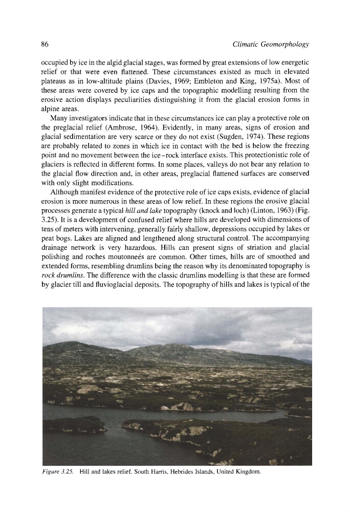
processes generate a typical hill and lake topography (knock and loch) (Linton, 1963) (Fig.
3.25). It is a development of confused relief where hills are developed with dimensions of
tens of meters with intervening, generally fairly shallow, depressions occupied by lakes or
peat bogs. Lakes are aligned and lengthened along structural control. The accompanying
drainage network is very hazardous. Hills can present signs of striation and glacial
polishing and roches moutonners are common. Other times, hills are of smoothed and
extended forms, resembling drumlins being the reason why its denominated topography is
rock drumlins. The difference with the classic drumlins modelling is that these are formed
by glacier till and fluvioglacial deposits. The topography of hills and lakes is typical of the
Figure 3.25. Hill and lakes relief. South Harris, Hebrides Islands, United Kingdom.
Climatic Geomorphology
occupied by ice in the algid glacial stages, was formed by great extensions of low energetic
relief or that were even flattened. These circumstances existed as much in elevated
plateaus as in low-altitude plains (Davies, 1969; Embleton and King, 1975a). Most of
these areas were covered by ice caps and the topographic modelling resulting from the
erosive action displays peculiarities distinguishing it from the glacial erosion forms in
alpine areas.
Many investigators indicate that in these circumstances ice can play a protective role on
the preglacial relief (Ambrose, 1964). Evidently, in many areas, signs of erosion and
glacial sedimentation are very scarce or they do not exist (Sugden, 1974). These regions
are probably related to zones in which ice in contact with the bed is below the freezing
point and no movement between the ice-rock interface exists. This protectionistic role of
glaciers is reflected in different forms. In some places, valleys do not bear any relation to
the glacial flow direction and, in other areas, preglacial flattened surfaces are conserved
with only slight modifications.
Although manifest evidence of the protective role of ice caps exists, evidence of glacial
erosion is more numerous in these areas of low relief. In these regions the erosive glacial
processes generate a typical hill and lake topography (knock and loch) (Linton, 1963) (Fig.
3.25). It is a development of confused relief where hills are developed with dimensions of
tens of meters with intervening, generally fairly shallow, depressions occupied by lakes or
peat bogs. Lakes are aligned and lengthened along structural control. The accompanying
drainage network is very hazardous. Hills can present signs of striation and glacial
polishing and roches moutonners are common. Other times, hills are of smoothed and
extended forms, resembling drumlins being the reason why its denominated topography is
rock drumlins. The difference with the classic drumlins modelling is that these are formed
by glacier till and fluvioglacial deposits. The topography of hills and lakes is typical of the
Figure 3.25. Hill and lakes relief. South Harris, Hebrides Islands, United Kingdom.