

Tropical landforms
561
Unconsolided
Slope 5%
ground
Slope 2% Erosion
70 cm
__
[ ........
- ....
, tL~,_,~.__
..~_____
. .......
:
~=~
Over
an0in0 cu, rasse
Grollag
/
-,...
t .
~,, Talus slope
~ulrasse unaer
'~
dissection
i~
eam
Subsidence
C
Remains of former
Ledge Cuirasse
Cuirasse
~
, " ". "......T., .........
~'~7,~
.~ "0
F
" .....
Gravelly ground
---,-.~
z,,#j,~.
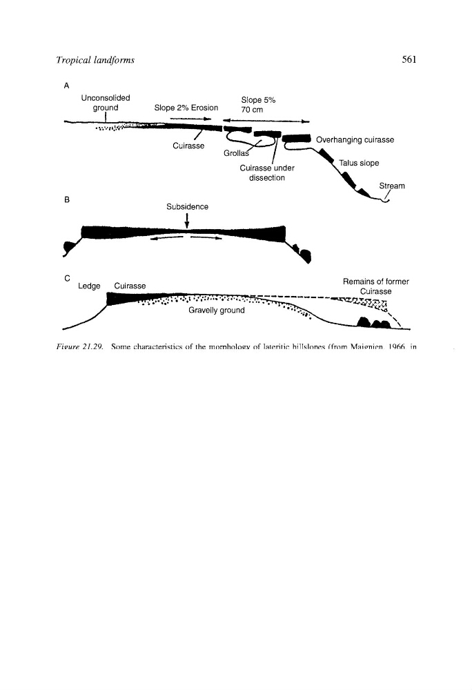
Figure 21.29. Some characteristics of the morphology of lateritic hillslopes (from Maignien, 1966, in
Thomas, 1974, Figure 15).
positions, whereas initially they were restricted to valleys. This variation in their relative
topographical situation is a case of relief inversion (Figure 20.25).
The process of laterite fragmentation (Figure 21.29) is mostly due to undermining by
mechanical and chemical removal produced by the underground water that flows below
the laterites. This leads to the development of a slight bending in the border of the platform
or mesa, called cambering (Moss, 1965). Subsurface water flow, favoured by laterite
fracturing and regolith porosity, can generate passages and caves of variable size (Ollier,
1965). This subsurface network can evolve producing ductile or brittle subsidence and
giving rise to closed depressions of metric to hectometric size. These pseudokarstic forms
are scattered upon the horizontal surfaces of the tabular hills and can develop diffuse or
sharp borders (De Chetelat, 1938; Goudie, 1973).
4. Tropical planation: etched plains
A great part of the tropical zone is covered by extended plains (Figure 20.2) upon which
detached hills (inselbergs) or mountain ridges stand out. There exist two main types of
plains: erosive and depositional; the former develop on very variable lithologies and
structures, whereas the latter constitute accumulation zones of alluvial and lacustrine
sediments.