

Fluvioglacial erosion and sedimentation
119
crests, and lengths from a few metres to 400 km (Aylsworth and Shilts, 1989; Punkari,
1997) (Figure 5.13). Their height can reach 200 m, with 3 km in width. These latter
dimensions are related to the total length, in such a manner that the longest eskers are
commonly the widest and highest. They can also appear as unique ridges or develop an
interconnected network with confluent and diffluent eskers that join the main ridge. The
slopes of the eskers can have angles of about 30 ~ close to the angle of repose, though when
they are degraded the gradient is between 5 and 10 ~ (Embleton and King, 1975a). The
deposits dip toward the margins of the esker and can show distortions due to the underlying ice melt.
Eskers originate in subglacial, englacial, supraglacial, and ice-marginal channels
(Figure 5.14). They develop above all after the peak flow at the end of summer, when the
velocity of flow of the channels diminishes, and can be destroyed totally or partially with
new peak flows (Sugden and John, 1976; Menzies and Shilts, 1996). The deposits of the
bottom of the subglacial channels can accumulate between the ice walls, and the shape of
the cross section of the tunnels plays an important role in the final esker morphology
(Price, 1973). The hypothesis of subglacial channels hardly explains the existence of
tunnels hundreds of kilometres long. The origin from englacial channels must be treated
jointly with that of a supraglacial origin. Studies of aerial photos obtained in different
years made in areas of fast ice retreat of the Casement Glacier in southeast Alaska and the
Breidamerkurj6kull Ice Sheet in Iceland reveal that the profiles of the esker base and crest
have diminished in height (Price, 1966, 1969) (Figure 5.15). This diminution is due to the
melting of buried ice during the period between the aerial photos. This indicates an
englacial or supraglacial origin.
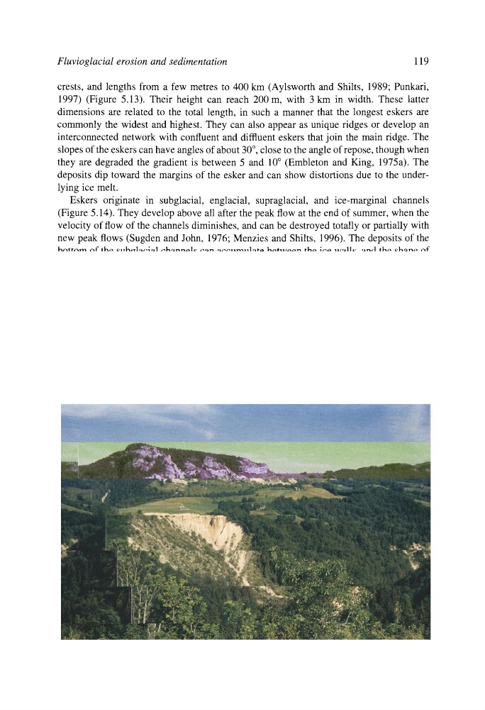
Figure 5.17. Kame terrace affected by badlands. Talon River, Jura of France. Photo: J.L. Pefia.
119
crests, and lengths from a few metres to 400 km (Aylsworth and Shilts, 1989; Punkari,
1997) (Figure 5.13). Their height can reach 200 m, with 3 km in width. These latter
dimensions are related to the total length, in such a manner that the longest eskers are
commonly the widest and highest. They can also appear as unique ridges or develop an
interconnected network with confluent and diffluent eskers that join the main ridge. The
slopes of the eskers can have angles of about 30 ~ close to the angle of repose, though when
they are degraded the gradient is between 5 and 10 ~ (Embleton and King, 1975a). The
deposits dip toward the margins of the esker and can show distortions due to the underlying ice melt.
Eskers originate in subglacial, englacial, supraglacial, and ice-marginal channels
(Figure 5.14). They develop above all after the peak flow at the end of summer, when the
velocity of flow of the channels diminishes, and can be destroyed totally or partially with
new peak flows (Sugden and John, 1976; Menzies and Shilts, 1996). The deposits of the
bottom of the subglacial channels can accumulate between the ice walls, and the shape of
the cross section of the tunnels plays an important role in the final esker morphology
(Price, 1973). The hypothesis of subglacial channels hardly explains the existence of
tunnels hundreds of kilometres long. The origin from englacial channels must be treated
jointly with that of a supraglacial origin. Studies of aerial photos obtained in different
years made in areas of fast ice retreat of the Casement Glacier in southeast Alaska and the
Breidamerkurj6kull Ice Sheet in Iceland reveal that the profiles of the esker base and crest
have diminished in height (Price, 1966, 1969) (Figure 5.15). This diminution is due to the
melting of buried ice during the period between the aerial photos. This indicates an
englacial or supraglacial origin.
Figure 5.17. Kame terrace affected by badlands. Talon River, Jura of France. Photo: J.L. Pefia.