

10. EXPLOITATION AND EVALUATION OF RETRIEVAL
ALGORITHMS FOR GEOSTATIONARY SATELLITE DATA
PROCESSING
79
in real-time through the meteorological Global Telecommunication
System (GTS).
In addition to this fully automated on-line processing, an off-line product
validation is performed. This validation monitors the product’s spatial and
temporal consistency with respect to the user’s accuracy requirements. In the
case of the CMW product, the validation is based on three main methods:
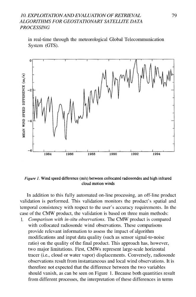
1. Comparison with in-situ observations. The CMW product is compared
with collocated radiosonde wind observations. These comparisons
provide relevant information to assess the impact of algorithm
modifications and input data quality (such as sensor signal-to-noise
ratio) on the quality of the final product. This approach has, however,
two major limitations. First, CMWs represent large-scale horizontal
tracer (i.e., cloud or water vapor) displacements. Conversely, radiosonde
observations result from instantaneous and local wind observations. It is
therefore not expected that the difference between the two variables
should vanish, as can be seen on Figure 1. Because both quantities result
from different processes, the interpretation of these differences in terms
ALGORITHMS FOR GEOSTATIONARY SATELLITE DATA
PROCESSING
79
in real-time through the meteorological Global Telecommunication
System (GTS).
In addition to this fully automated on-line processing, an off-line product
validation is performed. This validation monitors the product’s spatial and
temporal consistency with respect to the user’s accuracy requirements. In the
case of the CMW product, the validation is based on three main methods:
1. Comparison with in-situ observations. The CMW product is compared
with collocated radiosonde wind observations. These comparisons
provide relevant information to assess the impact of algorithm
modifications and input data quality (such as sensor signal-to-noise
ratio) on the quality of the final product. This approach has, however,
two major limitations. First, CMWs represent large-scale horizontal
tracer (i.e., cloud or water vapor) displacements. Conversely, radiosonde
observations result from instantaneous and local wind observations. It is
therefore not expected that the difference between the two variables
should vanish, as can be seen on Figure 1. Because both quantities result
from different processes, the interpretation of these differences in terms