

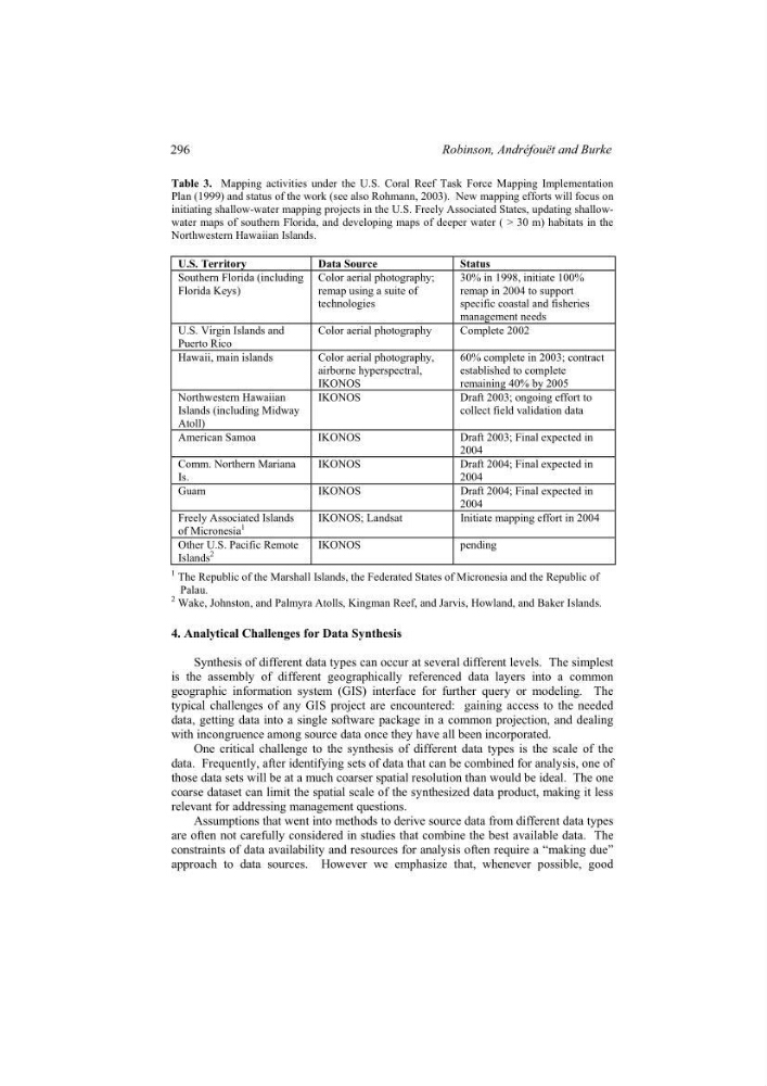
Table 3. Mapping activities under the U.S. Coral Reef Task Force Mapping Implementation
Plan (1999) and status of the work (see also Rohmann, 2003). New mapping efforts will focus on
initiating shallow-water mapping projects in the U.S. Freely Associated States, updating shallowwater maps of southern Florida, and developing maps of deeper water ( > 30 m) habitats in the
Northwestern Hawaiian Islands.
U.S. Territory
Data Source
Status
Southern Florida (including
Florida Keys)
Color aerial photography;
remap using a suite of
technologies
30% in 1998, initiate 100%
remap in 2004 to support
specific coastal and fisheries
management needs
U.S. Virgin Islands and
Puerto Rico
Color aerial photography
Complete 2002
Hawaii, main islands
Color aerial photography,
airborne hyperspectral,
IKONOS
60% complete in 2003; contract
established to complete
remaining 40% by 2005
Northwestern Hawaiian
Islands (including Midway
Atoll)
IKONOS
Draft 2003; ongoing effort to
collect field validation data
American Samoa
IKONOS
Draft 2003; Final expected in
2004
Comm. Northern Mariana
Is.
IKONOS
Draft 2004; Final expected in
2004
Guam
IKONOS
Draft 2004; Final expected in
2004
Freely Associated Islands
of Micronesia
1
IKONOS; Landsat
Initiate mapping effort in 2004
Other U.S. Pacific Remote
Islands
2
IKONOS
pending
1 The Republic of the Marshall Islands, the Federated States of Micronesia and the Republic of
Palau.
2 Wake, Johnston, and Palmyra Atolls, Kingman Reef, and Jarvis, Howland, and Baker Islands.
4. Analytical Challenges for Data Synthesis
Synthesis of different data types can occur at several different levels. The simplest
is the assembly of different geographically referenced data layers into a common
geographic information system (GIS) interface for further query or modeling. The
typical challenges of any GIS project are encountered: gaining access to the needed
data, getting data into a single software package in a common projection, and dealing
with incongruence among source data once they have all been incorporated.
One critical challenge to the synthesis of different data types is the scale of the
data. Frequently, after identifying sets of data that can be combined for analysis, one of
those data sets will be at a much coarser spatial resolution than would be ideal. The one
coarse dataset can limit the spatial scale of the synthesized data product, making it less
relevant for addressing management questions.
Assumptions that went into methods to derive source data from different data types
are often not carefully considered in studies that combine the best available data. The
constraints of data availability and resources for analysis often require a “making due”
approach to data sources. However we emphasize that, whenever possible, good
296
Robinson, Andréfouët and Burke
Plan (1999) and status of the work (see also Rohmann, 2003). New mapping efforts will focus on
initiating shallow-water mapping projects in the U.S. Freely Associated States, updating shallowwater maps of southern Florida, and developing maps of deeper water ( > 30 m) habitats in the
Northwestern Hawaiian Islands.
U.S. Territory
Data Source
Status
Southern Florida (including
Florida Keys)
Color aerial photography;
remap using a suite of
technologies
30% in 1998, initiate 100%
remap in 2004 to support
specific coastal and fisheries
management needs
U.S. Virgin Islands and
Puerto Rico
Color aerial photography
Complete 2002
Hawaii, main islands
Color aerial photography,
airborne hyperspectral,
IKONOS
60% complete in 2003; contract
established to complete
remaining 40% by 2005
Northwestern Hawaiian
Islands (including Midway
Atoll)
IKONOS
Draft 2003; ongoing effort to
collect field validation data
American Samoa
IKONOS
Draft 2003; Final expected in
2004
Comm. Northern Mariana
Is.
IKONOS
Draft 2004; Final expected in
2004
Guam
IKONOS
Draft 2004; Final expected in
2004
Freely Associated Islands
of Micronesia
1
IKONOS; Landsat
Initiate mapping effort in 2004
Other U.S. Pacific Remote
Islands
2
IKONOS
pending
1 The Republic of the Marshall Islands, the Federated States of Micronesia and the Republic of
Palau.
2 Wake, Johnston, and Palmyra Atolls, Kingman Reef, and Jarvis, Howland, and Baker Islands.
4. Analytical Challenges for Data Synthesis
Synthesis of different data types can occur at several different levels. The simplest
is the assembly of different geographically referenced data layers into a common
geographic information system (GIS) interface for further query or modeling. The
typical challenges of any GIS project are encountered: gaining access to the needed
data, getting data into a single software package in a common projection, and dealing
with incongruence among source data once they have all been incorporated.
One critical challenge to the synthesis of different data types is the scale of the
data. Frequently, after identifying sets of data that can be combined for analysis, one of
those data sets will be at a much coarser spatial resolution than would be ideal. The one
coarse dataset can limit the spatial scale of the synthesized data product, making it less
relevant for addressing management questions.
Assumptions that went into methods to derive source data from different data types
are often not carefully considered in studies that combine the best available data. The
constraints of data availability and resources for analysis often require a “making due”
approach to data sources. However we emphasize that, whenever possible, good
296
Robinson, Andréfouët and Burke