

approaches are required for a discrete map with relatively stable feature types (e.g.,
coral reef geomorphic zones) as compared with a continuous map depicting a
dynamic environmental variable (e.g., sea surface temperature). The differences in
these two primary types of maps are defined as follows:
• Discrete Maps: In these maps individual pixels are assigned a unique category to
identify reef composition (e.g., substrate or benthos type). These maps are used
to describe reef/non-reef areas, geomorphic zones, communities and habitats of
specific organisms.
• Continuous Maps: These are quantitative maps, where each pixel is a quantitative measure of a biophysical property (e.g., SST, depth, water column constituent concentration, optical properties, or percent live coral cover).
The aim of this chapter is to provide coral reef scientists and managers with an
overview and comparison of the accuracy measures commonly reported for remote
sensing derived map products. We first provide a brief description of sampling
design (Sect. 14.2.1) and then present the main accuracy assessment methods for
discrete (Sect. 14.2.2) and continuous (Sect. 14.2.3) remote sensing image-based
maps. This is followed by a literature review assessing the most commonly applied
accuracy assessment approaches and metrics used to assess maps of coral reef
systems (Sect. 14.3).
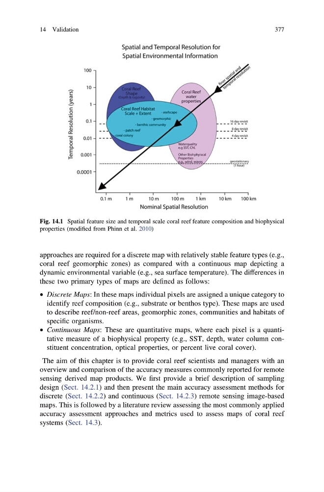
Fig. 14.1 Spatial feature size and temporal scale coral reef feature composition and biophysical
properties (modified from Phinn et al. 2010)
14 Validation
377
coral reef geomorphic zones) as compared with a continuous map depicting a
dynamic environmental variable (e.g., sea surface temperature). The differences in
these two primary types of maps are defined as follows:
• Discrete Maps: In these maps individual pixels are assigned a unique category to
identify reef composition (e.g., substrate or benthos type). These maps are used
to describe reef/non-reef areas, geomorphic zones, communities and habitats of
specific organisms.
• Continuous Maps: These are quantitative maps, where each pixel is a quantitative measure of a biophysical property (e.g., SST, depth, water column constituent concentration, optical properties, or percent live coral cover).
The aim of this chapter is to provide coral reef scientists and managers with an
overview and comparison of the accuracy measures commonly reported for remote
sensing derived map products. We first provide a brief description of sampling
design (Sect. 14.2.1) and then present the main accuracy assessment methods for
discrete (Sect. 14.2.2) and continuous (Sect. 14.2.3) remote sensing image-based
maps. This is followed by a literature review assessing the most commonly applied
accuracy assessment approaches and metrics used to assess maps of coral reef
systems (Sect. 14.3).
Fig. 14.1 Spatial feature size and temporal scale coral reef feature composition and biophysical
properties (modified from Phinn et al. 2010)
14 Validation
377