

Few detailed maps of these ecosystems are available since most coral fields are
at relatively inaccessible depths of 500–1,000 m. Conventional optical remote
sensing tools, which have been useful for mapping shallow-water coral reefs,
cannot typically map environments at depths [30 m, because of high light
absorption through the water column. Until recently, the only mapping tools that
could be applied to deep environments were submersibles and single-beam
acoustic sounders, which both produce spatially limited data. The development of
new acoustic survey techniques, however, has allowed data acquisition for large
areas covered with cold-water corals. For example, the wide swath corridors of
side-scan and multi-beam sonars have allowed scientists to explore the extent and
variability of these ecosystems, as well as to observe anthropogenic impacts to
these environments (e.g., destruction from trawling; Wheeler et al. 2005b; Roberts
et al. 2006). These ship-based acoustic tools have produced maps of greater area
and increased quality, but still have low positioning accuracy (*50 m; Wheeler
et al. 2005a) and/or reasonably coarse resolution (*30 m; Guinan et al. 2009).
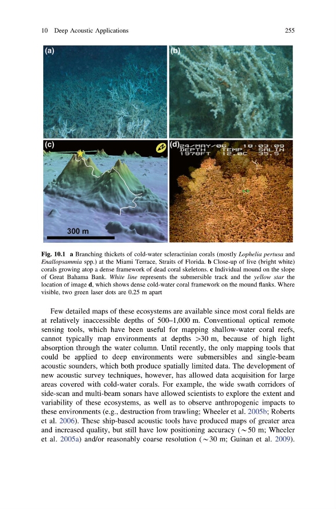
Fig. 10.1 a Branching thickets of cold-water scleractinian corals (mostly Lophelia pertusa and
Enallopsammia spp.) at the Miami Terrace, Straits of Florida. b Close-up of live (bright white)
corals growing atop a dense framework of dead coral skeletons. c Individual mound on the slope
of Great Bahama Bank. White line represents the submersible track and the yellow star the
location of image d, which shows dense cold-water coral framework on the mound flanks. Where
visible, two green laser dots are 0.25 m apart
10 Deep Acoustic Applications
255
at relatively inaccessible depths of 500–1,000 m. Conventional optical remote
sensing tools, which have been useful for mapping shallow-water coral reefs,
cannot typically map environments at depths [30 m, because of high light
absorption through the water column. Until recently, the only mapping tools that
could be applied to deep environments were submersibles and single-beam
acoustic sounders, which both produce spatially limited data. The development of
new acoustic survey techniques, however, has allowed data acquisition for large
areas covered with cold-water corals. For example, the wide swath corridors of
side-scan and multi-beam sonars have allowed scientists to explore the extent and
variability of these ecosystems, as well as to observe anthropogenic impacts to
these environments (e.g., destruction from trawling; Wheeler et al. 2005b; Roberts
et al. 2006). These ship-based acoustic tools have produced maps of greater area
and increased quality, but still have low positioning accuracy (*50 m; Wheeler
et al. 2005a) and/or reasonably coarse resolution (*30 m; Guinan et al. 2009).
Fig. 10.1 a Branching thickets of cold-water scleractinian corals (mostly Lophelia pertusa and
Enallopsammia spp.) at the Miami Terrace, Straits of Florida. b Close-up of live (bright white)
corals growing atop a dense framework of dead coral skeletons. c Individual mound on the slope
of Great Bahama Bank. White line represents the submersible track and the yellow star the
location of image d, which shows dense cold-water coral framework on the mound flanks. Where
visible, two green laser dots are 0.25 m apart
10 Deep Acoustic Applications
255