

resource manager’s toolbox for predicting and responding to bleaching events that
will affect the health of the coral reef ecosystems.
6.4 Conclusion
This chapter highlighted LiDAR applications that have successfully integrated this
remote sensing technology for navigational charting, engineering, benthic habitat
mapping, ecological modeling, marine geology and environmental change detection in coral reef ecosystems. These LiDAR applications demonstrated the depth
and breadth of applications to support research and mapping efforts on coral reefs
and surrounding ecosystems. Several case studies were described in greater detail
to demonstrate the utility of LiDAR technology to address specific research goals
and to illustrate the potential for wider applications. Understanding the geomorphology of coral reefs from a three-dimensional perspective using LiDAR offers
great potential to advance our knowledge of the functional linkages between
geomorphic structure and ecological processes in the marine environment. Further,
seamless land topography and marine bathymetry DEMs are now becoming
available, providing a valuable opportunity for the development of models that
quantify land-sea interactions. The future directions of LiDAR applications
involve mounting LiDAR sensors on alternative platforms, fusing LiDAR with
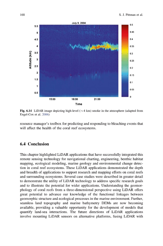
Fig. 6.14 LiDAR image depicting high-level (*4 km) smoke in the atmosphere (adapted from
Engel-Cox et al. 2006)
168
S. J. Pittman et al.
will affect the health of the coral reef ecosystems.
6.4 Conclusion
This chapter highlighted LiDAR applications that have successfully integrated this
remote sensing technology for navigational charting, engineering, benthic habitat
mapping, ecological modeling, marine geology and environmental change detection in coral reef ecosystems. These LiDAR applications demonstrated the depth
and breadth of applications to support research and mapping efforts on coral reefs
and surrounding ecosystems. Several case studies were described in greater detail
to demonstrate the utility of LiDAR technology to address specific research goals
and to illustrate the potential for wider applications. Understanding the geomorphology of coral reefs from a three-dimensional perspective using LiDAR offers
great potential to advance our knowledge of the functional linkages between
geomorphic structure and ecological processes in the marine environment. Further,
seamless land topography and marine bathymetry DEMs are now becoming
available, providing a valuable opportunity for the development of models that
quantify land-sea interactions. The future directions of LiDAR applications
involve mounting LiDAR sensors on alternative platforms, fusing LiDAR with
Fig. 6.14 LiDAR image depicting high-level (*4 km) smoke in the atmosphere (adapted from
Engel-Cox et al. 2006)
168
S. J. Pittman et al.