

as well as by threatening to inundate low lying areas as sea levels rise and storm
events intensify. Technologies such as LiDAR can help assess the risks of flooding
in the coastal zones by allowing governments to design, plan, implement and
evaluate climate change mitigation and adaptation strategies.
One such LiDAR project is the Future Coasts Program in Australia conducted
by the Victoria State Government Department of Sustainability and Environment
(VicDSE) (www.climatechange.vic.gov.au/index.html) to prepare Australia’s
coasts for the effects of climate change as well as manage and mitigate the long
term risks to coastal communities and natural environments (Sinclair and Quadros
2010). High resolution topographic and bathymetric information was needed to
assess the effects of rising sea levels which could lead to significant changes to the
coastline of Australia. This topographic and bathymetric information was collected
at 2.5–5 m horizontal resolution using two LiDAR sensors (LADS Mk II and
Hawk Eye II). The LADS Mk II system mapped the entire coastline 100 m inland
from the vegetation line offshore to the 20 m isobath. The Hawk Eye II system
mapped certain small bays and inlets to about 10 m in depth. The datasets from the
two systems were later integrated to create a seamless topographic/bathymetric
surface for the entire Victorian coastline. This seamless surface is currently being
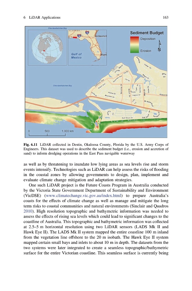
Fig. 6.11 LiDAR collected in Destin, Okaloosa County, Florida by the U.S. Army Corps of
Engineers. This dataset was used to describe the sediment budget (i.e., erosion and accretion of
sand) to inform dredging operations in the East Pass navigable waterway
6 LiDAR Applications
163
events intensify. Technologies such as LiDAR can help assess the risks of flooding
in the coastal zones by allowing governments to design, plan, implement and
evaluate climate change mitigation and adaptation strategies.
One such LiDAR project is the Future Coasts Program in Australia conducted
by the Victoria State Government Department of Sustainability and Environment
(VicDSE) (www.climatechange.vic.gov.au/index.html) to prepare Australia’s
coasts for the effects of climate change as well as manage and mitigate the long
term risks to coastal communities and natural environments (Sinclair and Quadros
2010). High resolution topographic and bathymetric information was needed to
assess the effects of rising sea levels which could lead to significant changes to the
coastline of Australia. This topographic and bathymetric information was collected
at 2.5–5 m horizontal resolution using two LiDAR sensors (LADS Mk II and
Hawk Eye II). The LADS Mk II system mapped the entire coastline 100 m inland
from the vegetation line offshore to the 20 m isobath. The Hawk Eye II system
mapped certain small bays and inlets to about 10 m in depth. The datasets from the
two systems were later integrated to create a seamless topographic/bathymetric
surface for the entire Victorian coastline. This seamless surface is currently being
Fig. 6.11 LiDAR collected in Destin, Okaloosa County, Florida by the U.S. Army Corps of
Engineers. This dataset was used to describe the sediment budget (i.e., erosion and accretion of
sand) to inform dredging operations in the East Pass navigable waterway
6 LiDAR Applications
163