

The fusion of LiDAR and aerial photography also highlighted an extensive,
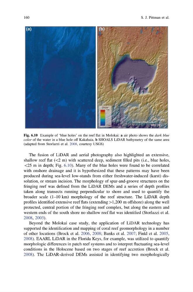
shallow reef flat (\2 m) with scattered deep, sediment filled pits (i.e., blue holes,
\25 m in depth; Fig. 6.10). Many of the blue holes were found to be correlated
with onshore drainage and it is hypothesized that these patterns may have been
produced during sea-level low-stands from either freshwater-induced (karst) dissolution, or stream incision. The morphology of spur-and-groove structures on the
fringing reef was defined from the LiDAR DEMs and a series of depth profiles
taken along transects running perpendicular to shore and used to quantify the
broader scale (1–10 km) morphology of the reef structure. The LiDAR depth
profiles identified extensive reef flats (extending[1,200 m offshore) along the well
protected, central portion of the fringing reef complex, but along the eastern and
western ends of the south shore no shallow reef flat was identified (Storlazzi et al.
2008, 2003).
Beyond the Molokai case study, the application of LiDAR technology has
supported the identification and mapping of coral reef geomorphology in a number
of other locations (Brock et al. 2006, 2008; Banks et al. 2007; Finkl et al. 2005,
2008). EAARL LiDAR in the Florida Keys, for example, was utilized to quantify
morphologic differences in patch reef systems and to interpret fluctuating sea-level
conditions in the Holocene based on two stages of reef accretion (Brock et al.
2008). The LiDAR-derived DEMs assisted in identifying two morphologically
Fig. 6.10 Example of ‘blue holes’ on the reef flat in Molokai: a air photo shows the dark blue
color of the water in a blue hole off Kakahaia, b SHOALS LiDAR bathymetry of the same area
(adapted from Storlazzi et al. 2008, courtesy USGS)
160
S. J. Pittman et al.
shallow reef flat (\2 m) with scattered deep, sediment filled pits (i.e., blue holes,
\25 m in depth; Fig. 6.10). Many of the blue holes were found to be correlated
with onshore drainage and it is hypothesized that these patterns may have been
produced during sea-level low-stands from either freshwater-induced (karst) dissolution, or stream incision. The morphology of spur-and-groove structures on the
fringing reef was defined from the LiDAR DEMs and a series of depth profiles
taken along transects running perpendicular to shore and used to quantify the
broader scale (1–10 km) morphology of the reef structure. The LiDAR depth
profiles identified extensive reef flats (extending[1,200 m offshore) along the well
protected, central portion of the fringing reef complex, but along the eastern and
western ends of the south shore no shallow reef flat was identified (Storlazzi et al.
2008, 2003).
Beyond the Molokai case study, the application of LiDAR technology has
supported the identification and mapping of coral reef geomorphology in a number
of other locations (Brock et al. 2006, 2008; Banks et al. 2007; Finkl et al. 2005,
2008). EAARL LiDAR in the Florida Keys, for example, was utilized to quantify
morphologic differences in patch reef systems and to interpret fluctuating sea-level
conditions in the Holocene based on two stages of reef accretion (Brock et al.
2008). The LiDAR-derived DEMs assisted in identifying two morphologically
Fig. 6.10 Example of ‘blue holes’ on the reef flat in Molokai: a air photo shows the dark blue
color of the water in a blue hole off Kakahaia, b SHOALS LiDAR bathymetry of the same area
(adapted from Storlazzi et al. 2008, courtesy USGS)
160
S. J. Pittman et al.