

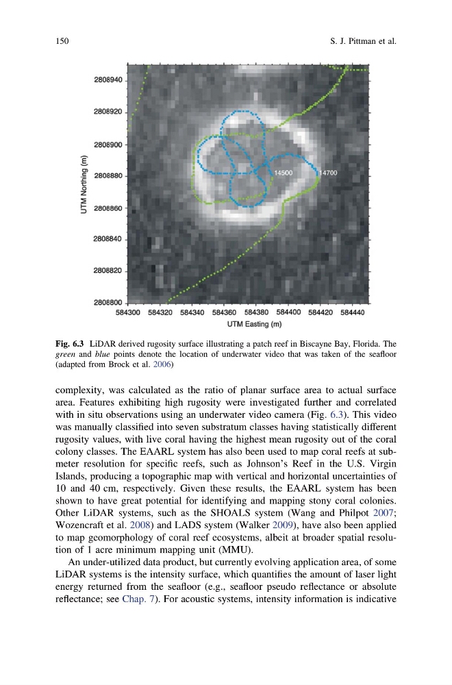
complexity, was calculated as the ratio of planar surface area to actual surface
area. Features exhibiting high rugosity were investigated further and correlated
with in situ observations using an underwater video camera (Fig. 6.3). This video
was manually classified into seven substratum classes having statistically different
rugosity values, with live coral having the highest mean rugosity out of the coral
colony classes. The EAARL system has also been used to map coral reefs at submeter resolution for specific reefs, such as Johnson’s Reef in the U.S. Virgin
Islands, producing a topographic map with vertical and horizontal uncertainties of
10 and 40 cm, respectively. Given these results, the EAARL system has been
shown to have great potential for identifying and mapping stony coral colonies.
Other LiDAR systems, such as the SHOALS system (Wang and Philpot 2007;
Wozencraft et al. 2008) and LADS system (Walker 2009), have also been applied
to map geomorphology of coral reef ecosystems, albeit at broader spatial resolution of 1 acre minimum mapping unit (MMU).
An under-utilized data product, but currently evolving application area, of some
LiDAR systems is the intensity surface, which quantifies the amount of laser light
energy returned from the seafloor (e.g., seafloor pseudo reflectance or absolute
reflectance; see Chap. 7). For acoustic systems, intensity information is indicative
Fig. 6.3 LiDAR derived rugosity surface illustrating a patch reef in Biscayne Bay, Florida. The
green and blue points denote the location of underwater video that was taken of the seafloor
(adapted from Brock et al. 2006)
150
S. J. Pittman et al.
area. Features exhibiting high rugosity were investigated further and correlated
with in situ observations using an underwater video camera (Fig. 6.3). This video
was manually classified into seven substratum classes having statistically different
rugosity values, with live coral having the highest mean rugosity out of the coral
colony classes. The EAARL system has also been used to map coral reefs at submeter resolution for specific reefs, such as Johnson’s Reef in the U.S. Virgin
Islands, producing a topographic map with vertical and horizontal uncertainties of
10 and 40 cm, respectively. Given these results, the EAARL system has been
shown to have great potential for identifying and mapping stony coral colonies.
Other LiDAR systems, such as the SHOALS system (Wang and Philpot 2007;
Wozencraft et al. 2008) and LADS system (Walker 2009), have also been applied
to map geomorphology of coral reef ecosystems, albeit at broader spatial resolution of 1 acre minimum mapping unit (MMU).
An under-utilized data product, but currently evolving application area, of some
LiDAR systems is the intensity surface, which quantifies the amount of laser light
energy returned from the seafloor (e.g., seafloor pseudo reflectance or absolute
reflectance; see Chap. 7). For acoustic systems, intensity information is indicative
Fig. 6.3 LiDAR derived rugosity surface illustrating a patch reef in Biscayne Bay, Florida. The
green and blue points denote the location of underwater video that was taken of the seafloor
(adapted from Brock et al. 2006)
150
S. J. Pittman et al.