

Free access of a long-term Landsat archive data provides opportunity to
detecting time-serial change dynamics at regional scale. In this study, Landsat
archive data is the core data of extracting urban LULC information. Some other
ancillary data are utilized as reference during Landsat data processing and accuracy
assessment. Landsat data are listed in Table 4.3.
The entire study area can be covered by the WRS-2 path-18/row-30 scene.
Images are projected in Universal Transverse Mercator (UTM) coordinates based
on World Geodetic System of1984 (WGS84) datum. Since the time span of this
study is from 1984 to 2013, one scene of each year is needed. To obtain high quality
data, images with no cloud and no haze were selected. Data for 1988, 2004, and
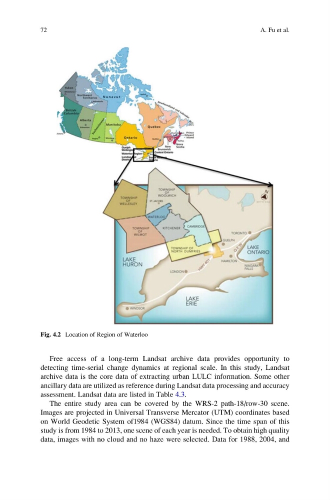
Fig. 4.2 Location of Region of Waterloo
72
A. Fu et al.
detecting time-serial change dynamics at regional scale. In this study, Landsat
archive data is the core data of extracting urban LULC information. Some other
ancillary data are utilized as reference during Landsat data processing and accuracy
assessment. Landsat data are listed in Table 4.3.
The entire study area can be covered by the WRS-2 path-18/row-30 scene.
Images are projected in Universal Transverse Mercator (UTM) coordinates based
on World Geodetic System of1984 (WGS84) datum. Since the time span of this
study is from 1984 to 2013, one scene of each year is needed. To obtain high quality
data, images with no cloud and no haze were selected. Data for 1988, 2004, and
Fig. 4.2 Location of Region of Waterloo
72
A. Fu et al.