

3.3.1.4 Scientific Satellites
A new type of satellite data for non-military use became available after 1972
(Landsat 1, spatial resolution 80 m) but a spatial resolution of approximately 1 m
was achieved at the end of the 21st century. However, Landsat images do not
provide sufficient spatial resolution for detailed mapping and monitoring. The new
generation of commercial satellites such as IKONOS, QuickBird, WorldView or
GeoEye provides images with excellent quality and sufficient resolution for
detailed mapping of small cities. In this study, satellite images were used for the
Citadel base plain map creation. The processed image was geometrically rectified
with 16 ground control points and converted into a vector map using single
photogrammetrical method. Landsat 7 (2000-06-19), IKONOS (2005-05-12) and
QuickBird (2005-08-23) data were used (Pavelka and Svatus ˇkova ´ 2008).
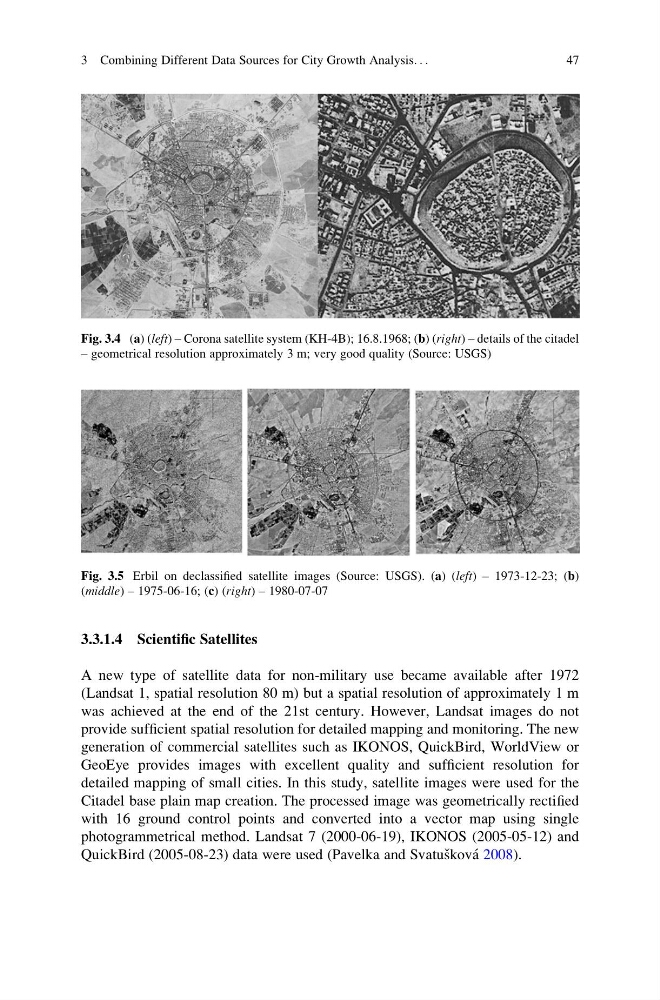
Fig. 3.4 (a) (left) – Corona satellite system (KH-4B); 16.8.1968; (b) (right) – details of the citadel
– geometrical resolution approximately 3 m; very good quality (Source: USGS)
Fig. 3.5 Erbil on declassified satellite images (Source: USGS). (a) (left) – 1973-12-23; (b)
(middle) – 1975-06-16; (c) (right) – 1980-07-07
3 Combining Different Data Sources for City Growth Analysis. . .
47
A new type of satellite data for non-military use became available after 1972
(Landsat 1, spatial resolution 80 m) but a spatial resolution of approximately 1 m
was achieved at the end of the 21st century. However, Landsat images do not
provide sufficient spatial resolution for detailed mapping and monitoring. The new
generation of commercial satellites such as IKONOS, QuickBird, WorldView or
GeoEye provides images with excellent quality and sufficient resolution for
detailed mapping of small cities. In this study, satellite images were used for the
Citadel base plain map creation. The processed image was geometrically rectified
with 16 ground control points and converted into a vector map using single
photogrammetrical method. Landsat 7 (2000-06-19), IKONOS (2005-05-12) and
QuickBird (2005-08-23) data were used (Pavelka and Svatus ˇkova ´ 2008).
Fig. 3.4 (a) (left) – Corona satellite system (KH-4B); 16.8.1968; (b) (right) – details of the citadel
– geometrical resolution approximately 3 m; very good quality (Source: USGS)
Fig. 3.5 Erbil on declassified satellite images (Source: USGS). (a) (left) – 1973-12-23; (b)
(middle) – 1975-06-16; (c) (right) – 1980-07-07
3 Combining Different Data Sources for City Growth Analysis. . .
47