

3.3.1.3 Military Satellite Images
Although civilian satellite data became available since early 1970s, better data in
terms of image resolution from some improved sensors, such as Landsat Thematic
Mapper (TM) and SPOT High Resolution Visible (HRV), have become available
for a much shorter period of time. These data may not be sufficient for some studies
that need to look backwards for a long period, such as urban growth since the World
War II. Given these limitations, the declassified satellite images from 1960s to
1970s can provide a very good information source to look into the past. For areas
where there are no other historical image data, it is important to include geo-data
sources. Note that military satellite data with 1–3 m spatial resolution acquired in
1960s are at our disposal. Since later 1990s, satellite images with 1 m resolution
Fig. 3.1 (a) (left) – a map of Erbil (1944); (b) (right) – South gate of the Al-Qala citadel in Erbil
on a photo taken in 1918 by an unknown author
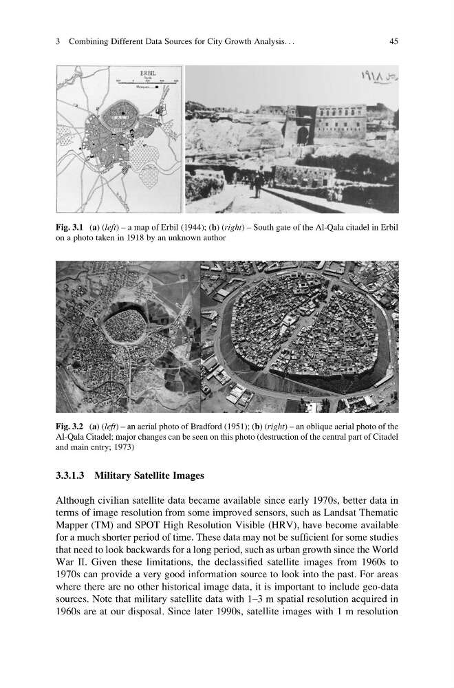
Fig. 3.2 (a) (left) – an aerial photo of Bradford (1951); (b) (right) – an oblique aerial photo of the
Al-Qala Citadel; major changes can be seen on this photo (destruction of the central part of Citadel
and main entry; 1973)
3 Combining Different Data Sources for City Growth Analysis. . .
45
Although civilian satellite data became available since early 1970s, better data in
terms of image resolution from some improved sensors, such as Landsat Thematic
Mapper (TM) and SPOT High Resolution Visible (HRV), have become available
for a much shorter period of time. These data may not be sufficient for some studies
that need to look backwards for a long period, such as urban growth since the World
War II. Given these limitations, the declassified satellite images from 1960s to
1970s can provide a very good information source to look into the past. For areas
where there are no other historical image data, it is important to include geo-data
sources. Note that military satellite data with 1–3 m spatial resolution acquired in
1960s are at our disposal. Since later 1990s, satellite images with 1 m resolution
Fig. 3.1 (a) (left) – a map of Erbil (1944); (b) (right) – South gate of the Al-Qala citadel in Erbil
on a photo taken in 1918 by an unknown author
Fig. 3.2 (a) (left) – an aerial photo of Bradford (1951); (b) (right) – an oblique aerial photo of the
Al-Qala Citadel; major changes can be seen on this photo (destruction of the central part of Citadel
and main entry; 1973)
3 Combining Different Data Sources for City Growth Analysis. . .
45