

sedimentation in the mouths of the rivers. These islands will become a peninsula
when they connect to the mainland.
10.4.2 Climate Analysis
Table 10.1 shows the result of calculating the wind data by Van Ly Obserbatory
Station, the average number of days by month and by directions.
From May to September, the typhoon season, the winds from E, ESE, SE, SSE, S
are strong. The wind directions in the typhoon season are from the sea to inland. Not
only is the coastal damage great, there is severe damage to the paddies from salty
sea water. Hainan Island of China protects the northern coast from the wind and
waves. The damage is less than in the southern part of the northern area of the
coastline of the Red River Delta,
From October to the following April, the winter season, the winds from NE,
ENE, E are strong. The wind in the winter damages the banks of the coastline and
washes away the planted mangroves. In all seasons, the wind is from NE–SE. The
wind heaves the waves up and they attack perpendicularly the banks of the
coastline. Also, paddies are damaged by the saline water blown from the sea.
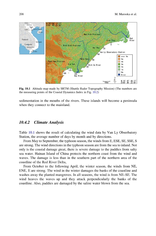
Fig. 10.1 Altitude map made by SRTM (Shuttle Rader Topography Mission) (The numbers are
the measuring points of the Coastal Dynamics Index in Fig. 10.2)
208
M. Murooka et al.
when they connect to the mainland.
10.4.2 Climate Analysis
Table 10.1 shows the result of calculating the wind data by Van Ly Obserbatory
Station, the average number of days by month and by directions.
From May to September, the typhoon season, the winds from E, ESE, SE, SSE, S
are strong. The wind directions in the typhoon season are from the sea to inland. Not
only is the coastal damage great, there is severe damage to the paddies from salty
sea water. Hainan Island of China protects the northern coast from the wind and
waves. The damage is less than in the southern part of the northern area of the
coastline of the Red River Delta,
From October to the following April, the winter season, the winds from NE,
ENE, E are strong. The wind in the winter damages the banks of the coastline and
washes away the planted mangroves. In all seasons, the wind is from NE–SE. The
wind heaves the waves up and they attack perpendicularly the banks of the
coastline. Also, paddies are damaged by the saline water blown from the sea.
Fig. 10.1 Altitude map made by SRTM (Shuttle Rader Topography Mission) (The numbers are
the measuring points of the Coastal Dynamics Index in Fig. 10.2)
208
M. Murooka et al.