

82
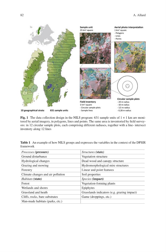
Fig. 1 The data collection design in the NILS program: 631 sample units of 1 × 1 km are monitored by aerial imagery, in polygons, lines and points. The same area is inventoried by field surveyors: in 12 circular sample plots, each comprising different radiuses, together with a line- intersect
inventory along 12 lines
Table 1 An example of how NILS groups and expresses the variables in the context of the DPSIR
framework
Processes (pressure)
Structures (state)
Ground disturbance
Vegetation structure
Hydrological changes
Dead wood and canopy structure
Grazing and mowing
Hydromorphological mire structures
Forestry
Linear and point features
Climate changes and air pollution
Soil properties
Habitats (state)
Species (impact)
Forest
Vegetation-forming plants
Wetlands and shores
Epiphytes
Grassland and heath
Grasslands indicators (e.g. grazing impact)
Cliffs, rocks, bare substrates
Game (droppings, etc.)
Man-made habitats (parks, etc.)
A. Allard
Fig. 1 The data collection design in the NILS program: 631 sample units of 1 × 1 km are monitored by aerial imagery, in polygons, lines and points. The same area is inventoried by field surveyors: in 12 circular sample plots, each comprising different radiuses, together with a line- intersect
inventory along 12 lines
Table 1 An example of how NILS groups and expresses the variables in the context of the DPSIR
framework
Processes (pressure)
Structures (state)
Ground disturbance
Vegetation structure
Hydrological changes
Dead wood and canopy structure
Grazing and mowing
Hydromorphological mire structures
Forestry
Linear and point features
Climate changes and air pollution
Soil properties
Habitats (state)
Species (impact)
Forest
Vegetation-forming plants
Wetlands and shores
Epiphytes
Grassland and heath
Grasslands indicators (e.g. grazing impact)
Cliffs, rocks, bare substrates
Game (droppings, etc.)
Man-made habitats (parks, etc.)
A. Allard