

50
There are a number of satellite-based AOD products, primarily those derived
from MODIS (Green et al. 2009). However, these products are produced at low
spatial resolution (e.g., 1 km) and are generally not obtained at the same time as the
image to be corrected. Furthermore, the downloading and processing of extra third
party data is potentially a significant overhead for the correction of individual
images. Table 4 provides an overview and reference to sources and algorithms for
the retrieval of AOD.
For the correction of atmospheric water, there are a number of sources for
water vapor within the vertical path (Table 5). The most commonly used sources are
from third party satellites such as the MODIS. However, average climate data and
ground-based measurements have also been used.
a)
b)
c)
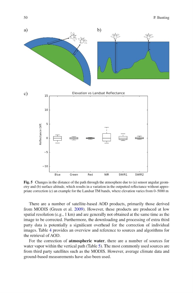
Fig. 5 Changes in the distance of the path through the atmosphere due to (a) sensor angular geometry and (b) surface altitude, which results in a variation in the outputted reflectance without appropriate correction (c) an example for the Landsat TM bands, where elevation varies from 0–5000 m
P. Bunting
There are a number of satellite-based AOD products, primarily those derived
from MODIS (Green et al. 2009). However, these products are produced at low
spatial resolution (e.g., 1 km) and are generally not obtained at the same time as the
image to be corrected. Furthermore, the downloading and processing of extra third
party data is potentially a significant overhead for the correction of individual
images. Table 4 provides an overview and reference to sources and algorithms for
the retrieval of AOD.
For the correction of atmospheric water, there are a number of sources for
water vapor within the vertical path (Table 5). The most commonly used sources are
from third party satellites such as the MODIS. However, average climate data and
ground-based measurements have also been used.
a)
b)
c)
Fig. 5 Changes in the distance of the path through the atmosphere due to (a) sensor angular geometry and (b) surface altitude, which results in a variation in the outputted reflectance without appropriate correction (c) an example for the Landsat TM bands, where elevation varies from 0–5000 m
P. Bunting