

171
understorey R. ponticum. UAV imagery does, however, have the potential to provide
a platform for overcoming these limiting factors if the low cost can be balanced with
sufficient image quality. Rather than a tool to replace ground surveys, we propose
that UAV imagery complements the work of ground survey teams, providing a better overview to help map their target habitats.
Study Area
The site was chosen by the Gwaun catchment area Invasive Species Department
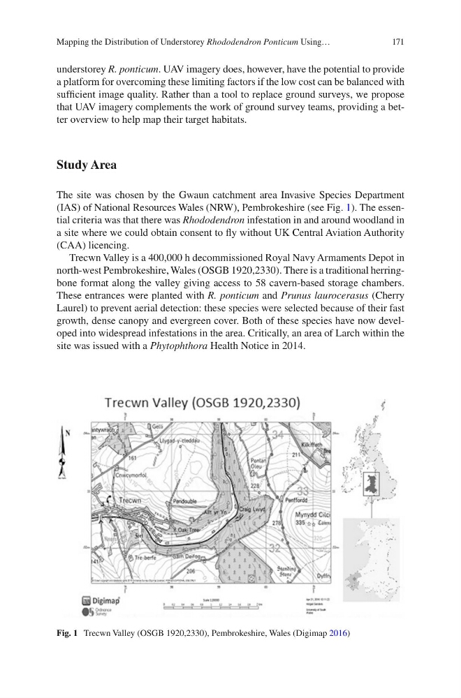
(IAS) of National Resources Wales (NRW), Pembrokeshire (see Fig. 1). The essential criteria was that there was Rhododendron infestation in and around woodland in
a site where we could obtain consent to fly without UK Central Aviation Authority
(CAA) licencing.
Trecwn Valley is a 400,000 h decommissioned Royal Navy Armaments Depot in
north-west Pembrokeshire, Wales (OSGB 1920,2330). There is a traditional herringbone format along the valley giving access to 58 cavern-based storage chambers.
These entrances were planted with R. ponticum and Prunus laurocerasus (Cherry
Laurel) to prevent aerial detection: these species were selected because of their fast
growth, dense canopy and evergreen cover. Both of these species have now developed into widespread infestations in the area. Critically, an area of Larch within the
site was issued with a Phytophthora Health Notice in 2014.
Fig. 1 Trecwn Valley (OSGB 1920,2330), Pembrokeshire, Wales (Digimap 2016)
Mapping the Distribution of Understorey Rhododendron Ponticum Using…
understorey R. ponticum. UAV imagery does, however, have the potential to provide
a platform for overcoming these limiting factors if the low cost can be balanced with
sufficient image quality. Rather than a tool to replace ground surveys, we propose
that UAV imagery complements the work of ground survey teams, providing a better overview to help map their target habitats.
Study Area
The site was chosen by the Gwaun catchment area Invasive Species Department
(IAS) of National Resources Wales (NRW), Pembrokeshire (see Fig. 1). The essential criteria was that there was Rhododendron infestation in and around woodland in
a site where we could obtain consent to fly without UK Central Aviation Authority
(CAA) licencing.
Trecwn Valley is a 400,000 h decommissioned Royal Navy Armaments Depot in
north-west Pembrokeshire, Wales (OSGB 1920,2330). There is a traditional herringbone format along the valley giving access to 58 cavern-based storage chambers.
These entrances were planted with R. ponticum and Prunus laurocerasus (Cherry
Laurel) to prevent aerial detection: these species were selected because of their fast
growth, dense canopy and evergreen cover. Both of these species have now developed into widespread infestations in the area. Critically, an area of Larch within the
site was issued with a Phytophthora Health Notice in 2014.
Fig. 1 Trecwn Valley (OSGB 1920,2330), Pembrokeshire, Wales (Digimap 2016)
Mapping the Distribution of Understorey Rhododendron Ponticum Using…