

113
Fig. 11 Location of the slack boundaries collected using a hand-held GPS device in the field
Fig. 12 Percentage of pixels classified correctly within the slack boundaries seen in Fig. 10 for all
layers chosen for further field assessment. The chosen layer is EODHaM_ERF
Mapping Coastal Habitats in Wales
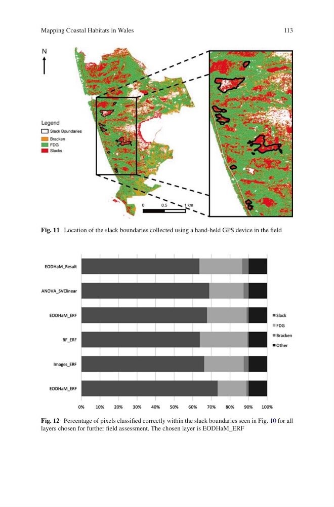
Fig. 11 Location of the slack boundaries collected using a hand-held GPS device in the field
Fig. 12 Percentage of pixels classified correctly within the slack boundaries seen in Fig. 10 for all
layers chosen for further field assessment. The chosen layer is EODHaM_ERF
Mapping Coastal Habitats in Wales