

20 Remote Sensing of African Lakes: A Review
405
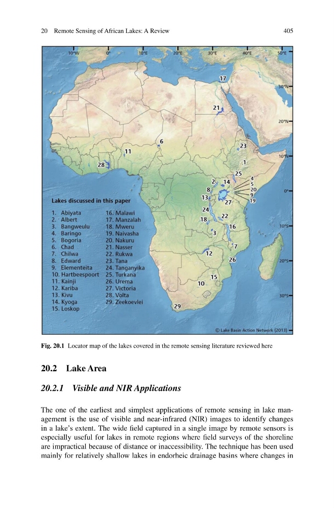
Fig. 20.1 Locator map of the lakes covered in the remote sensing literature reviewed here
20.2 Lake Area
20.2.1 Visible and NIR Applications
The one of the earliest and simplest applications of remote sensing in lake management is the use of visible and near-infrared (NIR) images to identify changes
in a lake’s extent. The wide field captured in a single image by remote sensors is
especially useful for lakes in remote regions where field surveys of the shoreline
are impractical because of distance or inaccessibility. The technique has been used
mainly for relatively shallow lakes in endorheic drainage basins where changes in
405
Fig. 20.1 Locator map of the lakes covered in the remote sensing literature reviewed here
20.2 Lake Area
20.2.1 Visible and NIR Applications
The one of the earliest and simplest applications of remote sensing in lake management is the use of visible and near-infrared (NIR) images to identify changes
in a lake’s extent. The wide field captured in a single image by remote sensors is
especially useful for lakes in remote regions where field surveys of the shoreline
are impractical because of distance or inaccessibility. The technique has been used
mainly for relatively shallow lakes in endorheic drainage basins where changes in